MyTopo
Roxbury Kansas US Topo Map
Couldn't load pickup availability
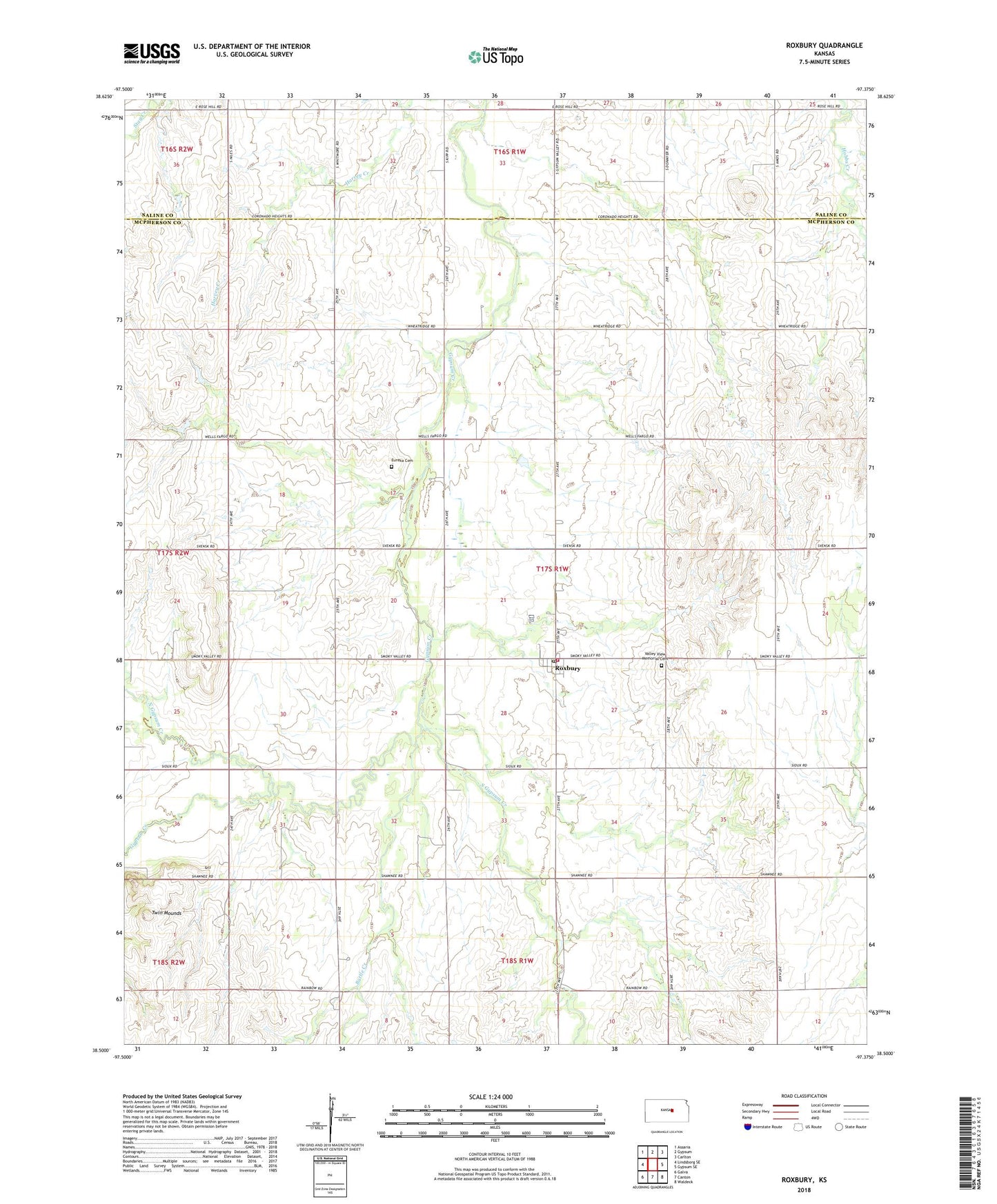
2022 topographic map quadrangle Roxbury in the state of Kansas. Scale: 1:24000. Based on the newly updated USGS 7.5' US Topo map series, this map is in the following counties: McPherson, Saline. The map contains contour data, water features, and other items you are used to seeing on USGS maps, but also has updated roads and other features. This is the next generation of topographic maps. Printed on high-quality waterproof paper with UV fade-resistant inks.
Quads adjacent to this one:
West: Lindsborg SE
Northwest: Assaria
North: Gypsum
Northeast: Carlton
East: Gypsum SE
Southeast: Waldeck
South: Canton
Southwest: Galva
This map covers the same area as the classic USGS quad with code o38097e4.
Contains the following named places: Battle Creek, Burch Oil Field, Crowther Oil Field, Digby, Eureka Cemetery, Georob Oil Field, Gypsum Creek Oil Field, Harvey Creek, Henne Oil Field, McPherson County Rural Fire District 6 Roxbury, North Gypsum Creek, Roxbury, Roxbury Census Designated Place, Roxbury Oil Field, Roxbury Post Office, Roxbury United Methodist Church, Roxbury Wastewater Treatment Plant, South Gypsum Creek, South Roxbury Oil Field, Team Marketing Alliance Grain Elevator Number 34, Township of Gypsum Creek, Twin Mounds, Valley View Memorial Cemetery