MyTopo
Atchison NE Kansas US Topo Map
Couldn't load pickup availability
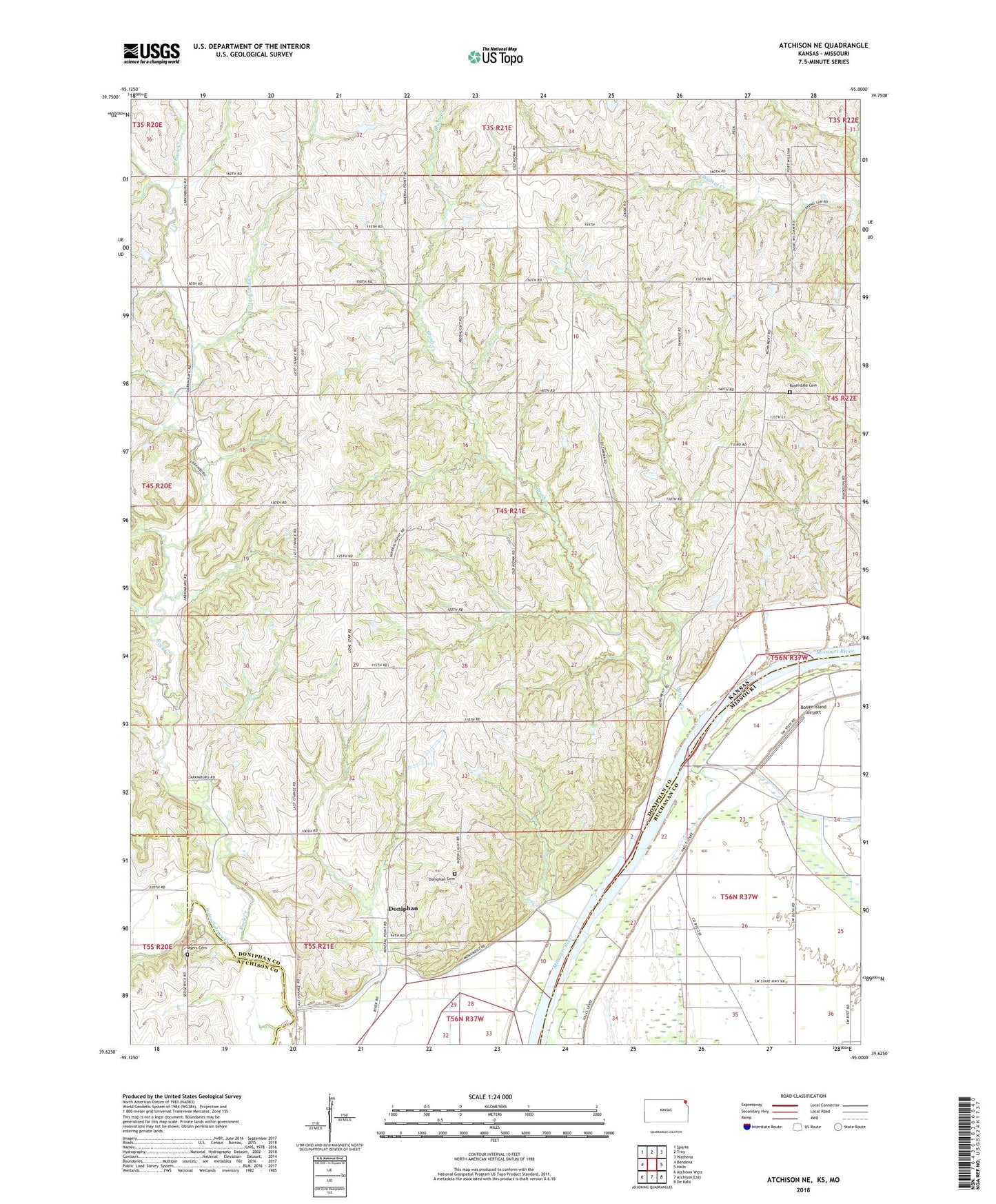
2022 topographic map quadrangle Atchison NE in the states of Kansas, Missouri. Scale: 1:24000. Based on the newly updated USGS 7.5' US Topo map series, this map is in the following counties: Doniphan, Buchanan, Atchison. The map contains contour data, water features, and other items you are used to seeing on USGS maps, but also has updated roads and other features. This is the next generation of topographic maps. Printed on high-quality waterproof paper with UV fade-resistant inks.
Quads adjacent to this one:
West: Bendena
Northwest: Sparks
North: Troy
Northeast: Wathena
East: Halls
Southeast: De Kalb
South: Atchison East
Southwest: Atchison West
Contains the following named places: Booze Island Airport, Brenner, Brenner School, Brenner Station, Brush Creek, Brush Creek School, Cordonier School, Cottonwood Creek, Doniphan, Doniphan Cemetery, Doniphan Station, Eureka School, Geary, Geary School, Liberty School, Marion Church, Myers Cemetery, Oak Grove School, Randolph School, Rock Creek, Rock School, Rosendale Cemetery, Saint Johns Church, Singleton Lake, Spring Grove School, Township of Lake, Township of Marion, Township of Wayne, Wilson School