MyTopo
Halls Missouri US Topo Map
Couldn't load pickup availability
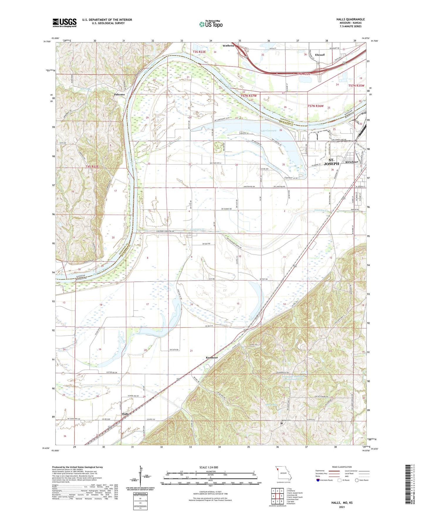
2021 topographic map quadrangle Halls in the states of Missouri, Kansas. Scale: 1:24000. Based on the newly updated USGS 7.5' US Topo map series, this map is in the following counties: Buchanan, Doniphan. The map contains contour data, water features, and other items you are used to seeing on USGS maps, but also has updated roads and other features. This is the next generation of topographic maps. Printed on high-quality waterproof paper with UV fade-resistant inks.
Quads adjacent to this one:
West: Atchison NE
Northwest: Troy
North: Wathena
Northeast: Saint Joseph North
East: Saint Joseph South
Southeast: Dearborn
South: De Kalb
Southwest: Atchison East
This map covers the same area as the classic USGS quad with code o39094f8.
Contains the following named places: Bethel Cemetery, Bethel School, Browley Chapel, Contrary Creek, Elwood Sewer Treatment Plant, Farmland Industries Incorporated Lake, Farmland Industries Incorporated Lake Dam, Halls, Halls Lake, Halls School, Halls Station, Horseshoe Lake, Hyde School, Kenmoor, Kirscher School, Kirschner, Lake Contrary, Lake Contrary Elementary School, Lake Station, Lake Station School, Lower Lake Contrary, Muskrat Lake, New Home Church, New Mud Lake, Old Mud Lake, Palermo, Palermo School, Peters Creek, Scottys Lake Dam, Shepherd School, Sunflower Village Mobile Home Park, Township of Wayne, Walnut Creek, Wathena Sewer Treatment Plant, Weiss School, ZIP Codes: 64504, 66024