MyTopo
Athol Kansas US Topo Map
Couldn't load pickup availability
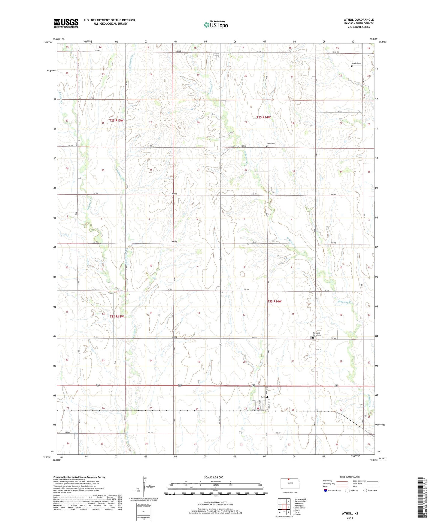
2022 topographic map quadrangle Athol in the state of Kansas. Scale: 1:24000. Based on the newly updated USGS 7.5' US Topo map series, this map is in the following counties: Smith. The map contains contour data, water features, and other items you are used to seeing on USGS maps, but also has updated roads and other features. This is the next generation of topographic maps. Printed on high-quality waterproof paper with UV fade-resistant inks.
Quads adjacent to this one:
West: Kensington
Northwest: Kensington NE
North: Bachelors Run
Northeast: Reamsville
East: Smith Center
Southeast: Gaylord
South: Cedar
Southwest: Kirwin
This map covers the same area as the classic USGS quad with code o39098g8.
Contains the following named places: Athol, Athol City and Rural Fire Department, Central Plains Co - Operative Grain Elevator Number 2, City of Athol, Clifford, Cottonwood Creek, Covington, Meade Cemetery, Pleasant View Cemetery, Township of Lane, Township of Pleasant, Zion Cemetery, ZIP Code: 66932