MyTopo
Kensington NE Kansas US Topo Map
Couldn't load pickup availability
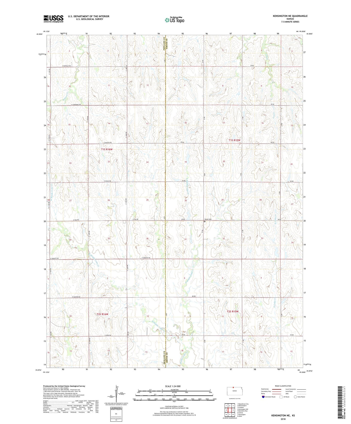
2022 topographic map quadrangle Kensington NE in the state of Kansas. Scale: 1:24000. Based on the newly updated USGS 7.5' US Topo map series, this map is in the following counties: Smith, Phillips. The map contains contour data, water features, and other items you are used to seeing on USGS maps, but also has updated roads and other features. This is the next generation of topographic maps. Printed on high-quality waterproof paper with UV fade-resistant inks.
Quads adjacent to this one:
West: Kensington NW
Northwest: Republican City
North: Bloomington
Northeast: Franklin
East: Bachelors Run
Southeast: Athol
South: Kensington
Southwest: Gretna
This map covers the same area as the classic USGS quad with code o39099h1.
Contains the following named places: Beulah Church, East Middle Cedar Creek, Fairview Stone Cemetery, New Hope, Ohio, Pleasant Green, Pleasant Green Assembly of God, Saint John Church, Township of German, Township of Sumner, West Middle Cedar Creek