MyTopo
Bazine Kansas US Topo Map
Couldn't load pickup availability
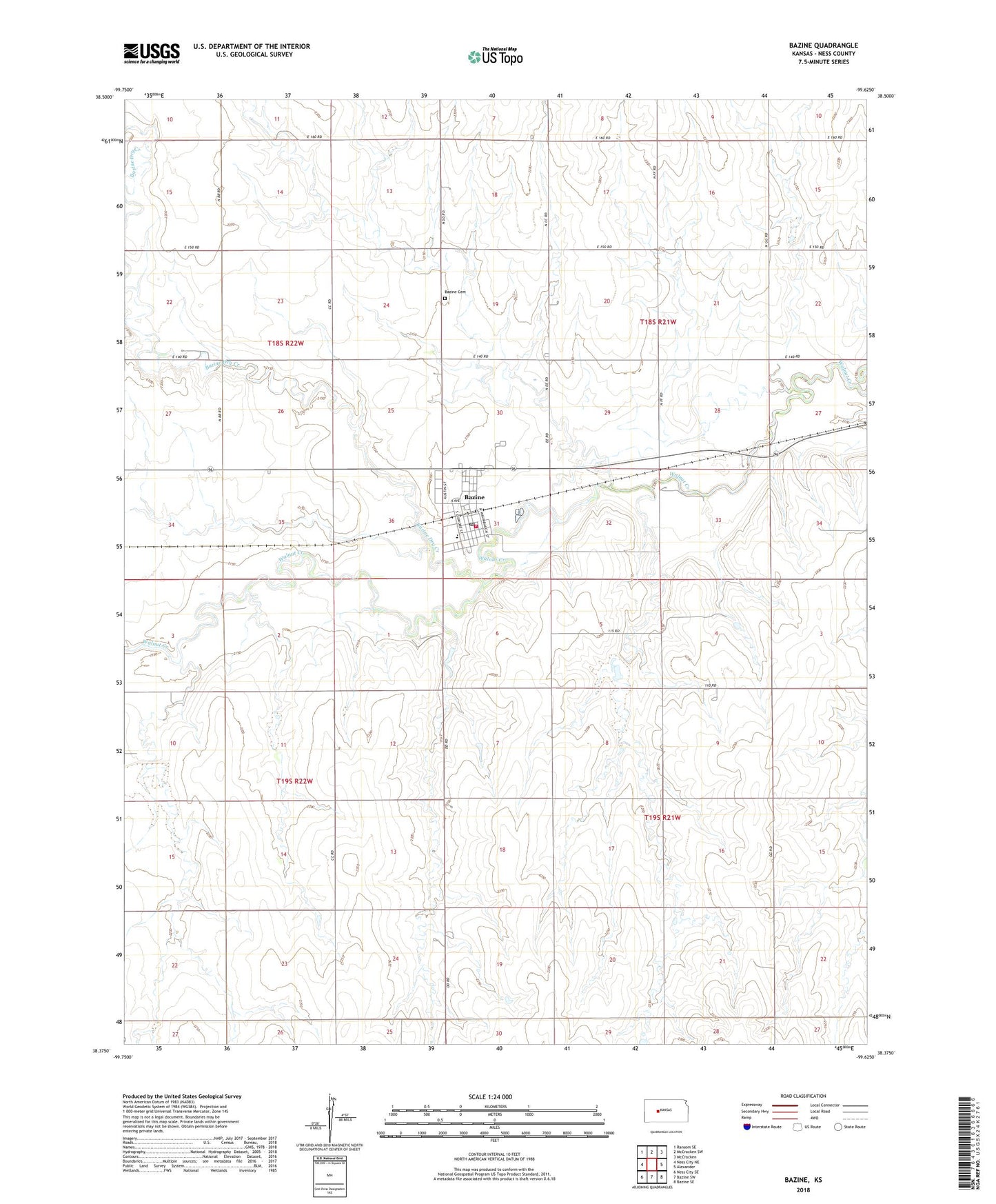
2022 topographic map quadrangle Bazine in the state of Kansas. Scale: 1:24000. Based on the newly updated USGS 7.5' US Topo map series, this map is in the following counties: Ness. The map contains contour data, water features, and other items you are used to seeing on USGS maps, but also has updated roads and other features. This is the next generation of topographic maps. Printed on high-quality waterproof paper with UV fade-resistant inks.
Quads adjacent to this one:
West: Ness City NE
Northwest: Ransom SE
North: McCracken SW
Northeast: McCracken
East: Alexander
Southeast: Bazine SE
South: Bazine SW
Southwest: Ness City SE
This map covers the same area as the classic USGS quad with code o38099d6.
Contains the following named places: Bazine, Bazine Cemetery, Bazine City Hall, Bazine Dry Creek, Bazine Post Office, Bazine Rural Fire Department, Bazine Seventh Day Adventist Church, Bazine United Methodist Church, Bazine Wastewater Plant, City of Bazine, First Baptist Church, Margheim Oil Field, Saint Luke Lutheran Church, Saint Paul Congregational Church, Township of Bazine, Western Plains South Elementary / Junior High School, ZIP Code: 67516