MyTopo
Alexander Kansas US Topo Map
Couldn't load pickup availability
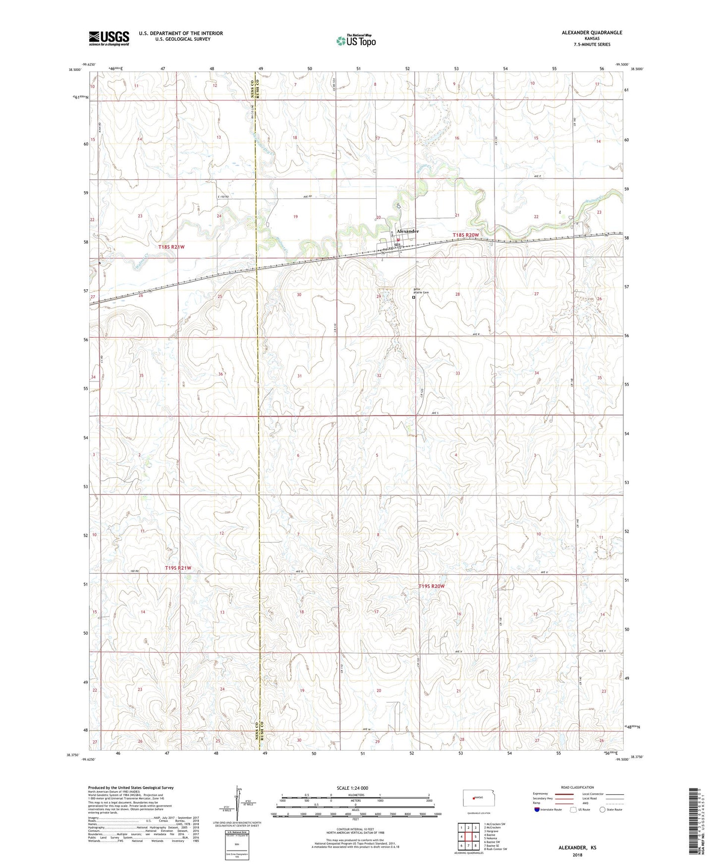
2022 topographic map quadrangle Alexander in the state of Kansas. Scale: 1:24000. Based on the newly updated USGS 7.5' US Topo map series, this map is in the following counties: Rush, Ness. The map contains contour data, water features, and other items you are used to seeing on USGS maps, but also has updated roads and other features. This is the next generation of topographic maps. Printed on high-quality waterproof paper with UV fade-resistant inks.
Quads adjacent to this one:
West: Bazine
Northwest: McCracken SW
North: McCracken
Northeast: Hargrave
East: Nekoma
Southeast: Rush Center SW
South: Bazine SE
Southwest: Bazine SW
This map covers the same area as the classic USGS quad with code o38099d5.
Contains the following named places: Alexander, Alexander Dry Creek, Alexander Elementary School, Alexander Post Office, Alexander United Methodist Church, Alexander Wastewater Treatment Facility, Belle Prairie Cemetery, City of Alexander, Golden Keys Senior Center, Mid - State Farmers Co - Operative Grain Elevator Number 2, Rush County Dam, Rush County Fire District 1 Alexander, Township of Alexander-Belle Prairie, Webs Oil Field, ZIP Code: 67513