MyTopo
Bogue Kansas US Topo Map
Couldn't load pickup availability
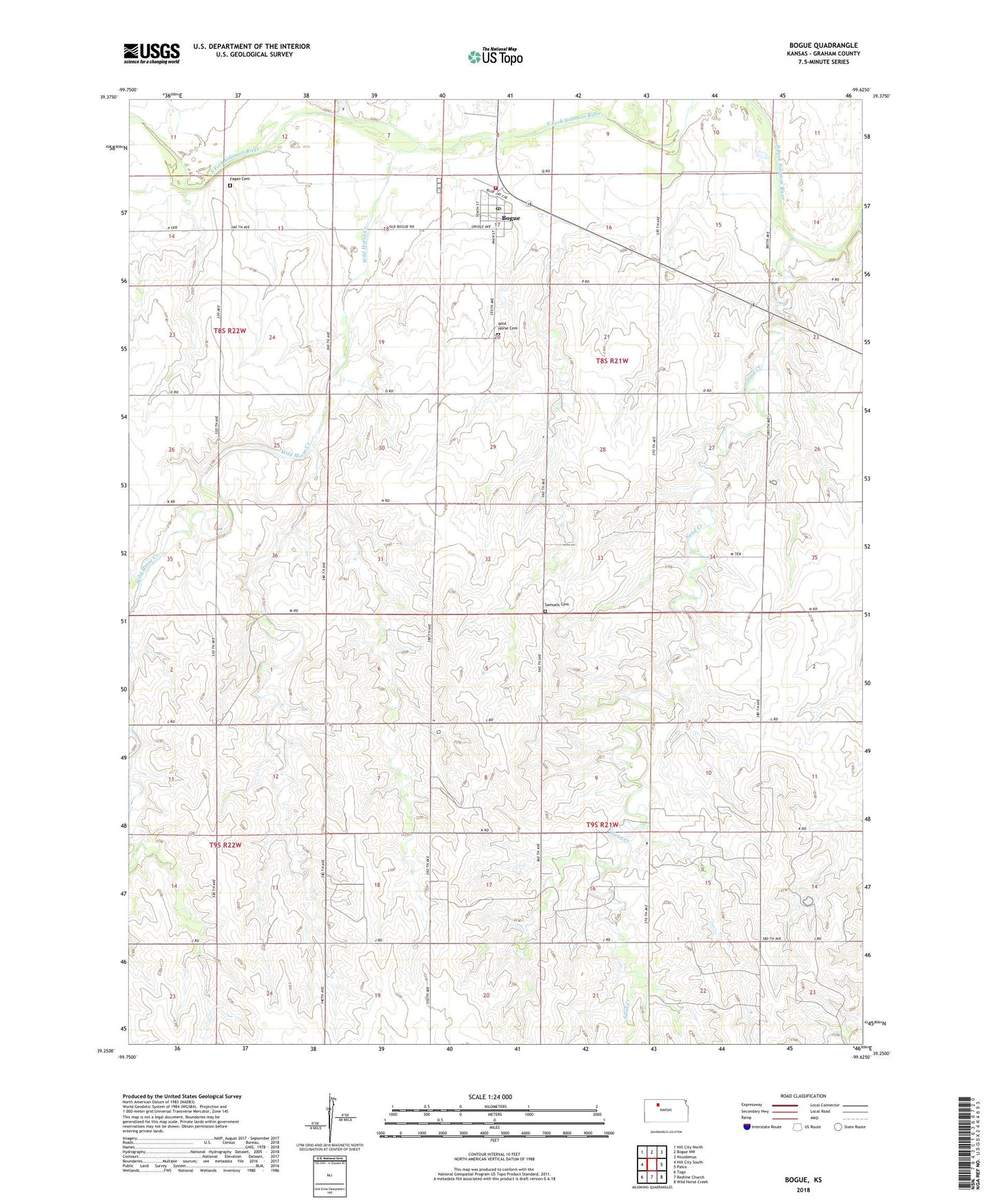
2022 topographic map quadrangle Bogue in the state of Kansas. Scale: 1:24000. Based on the newly updated USGS 7.5' US Topo map series, this map is in the following counties: Graham. The map contains contour data, water features, and other items you are used to seeing on USGS maps, but also has updated roads and other features. This is the next generation of topographic maps. Printed on high-quality waterproof paper with UV fade-resistant inks.
Quads adjacent to this one:
West: Hill City South
Northwest: Hill City North
North: Bogue NW
Northeast: Nicodemus
East: Palco
Southeast: Wild Horse Creek
South: Redline Church
Southwest: Togo
This map covers the same area as the classic USGS quad with code o39099c6.
Contains the following named places: Bogue, Bogue Elementary School, Bogue Post Office, Bogue Town Hall, Bogue United Methodist Church, Bogue Wastewater Plant, City of Bogue, Fagan Cemetery, Frontier Agricultural Grain Elevator Number 14, Graham County Rural Fire Department Station 3, Kebar, Samuels Cemetery, Sand Creek, Township of Wildhorse, Wild Horse, Wild Horse Cemetery, Wild Horse Creek