MyTopo
Palco Kansas US Topo Map
Couldn't load pickup availability
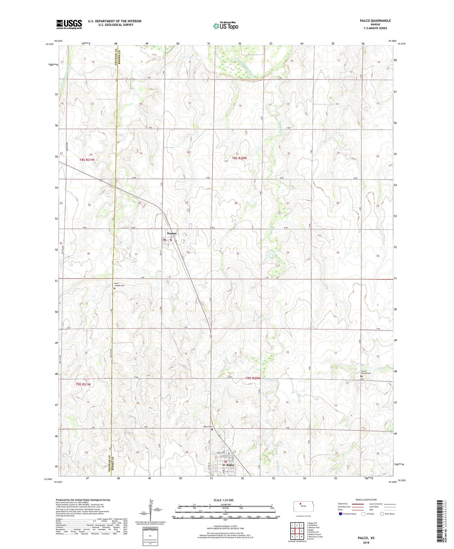
2022 topographic map quadrangle Palco in the state of Kansas. Scale: 1:24000. Based on the newly updated USGS 7.5' US Topo map series, this map is in the following counties: Rooks, Graham. The map contains contour data, water features, and other items you are used to seeing on USGS maps, but also has updated roads and other features. This is the next generation of topographic maps. Printed on high-quality waterproof paper with UV fade-resistant inks.
Quads adjacent to this one:
West: Bogue
Northwest: Bogue NW
North: Nicodemus
Northeast: Webster Dam
East: Stockton SW
Southeast: Zurich
South: Wild Horse Creek
Southwest: Redline Church
This map covers the same area as the classic USGS quad with code o39099c5.
Contains the following named places: Benoits Dusty Creek, City of Damar, City of Palco, Cresson, Damar, Damar Fire Department, Damar Junior High School, Damar Middle School, Damar Post Office, Damar Wastewater Plant, Dusty Creek, Gra-Rook North Oil Field, Gra-Rook Oil Field, Green Mound Cemetery, Morel Oil Field, Palco, Palco Cemetery, Palco City Hall, Palco Fire Department, Palco Post Office, Palco Public Library, Palco United Methodist Church, Palco Wastewater Plant, Saint Joseph Cemetery, Saint Joseph's Church, Spring Creek, Township 7, Township 8, ZIP Code: 67632