
MyTopo
Burden Kansas US Topo Map
Couldn't load pickup availability
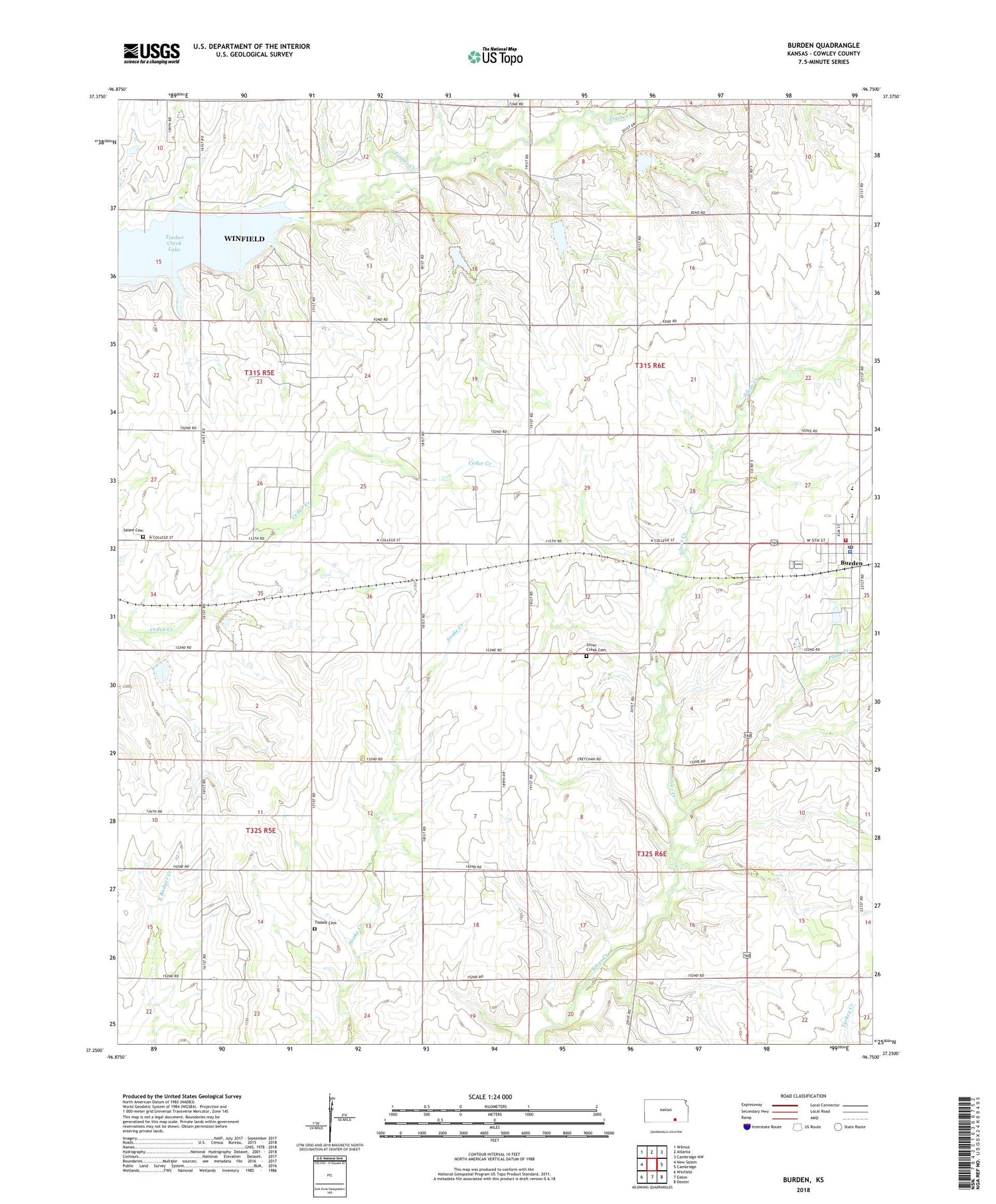
2018 topographic map quadrangle Burden in the state of Kansas. Scale: 1:24000. Based on the newly updated USGS 7.5' US Topo map series, this map is in the following counties: Cowley. The map contains contour data, water features, and other items you are used to seeing on USGS maps, but also has updated roads and other features. This is the next generation of topographic maps. Printed on high-quality waterproof paper with UV fade-resistant inks.
Quads adjacent to this one:
West: New Salem
Northwest: Wilmot
North: Atlanta
Northeast: Cambridge NW
East: Cambridge
Southeast: Dexter
South: Eaton
Southwest: Winfield
Contains the following named places: Bolack Oil Field, Burden, Burden City Hall, Burden Oil Field, Burden Police Department, Burden Post Office, Burden United Methodist Church, Burden Wastewater Plant, Central Elementary School, Central Junior - Senior High School, City of Burden, Cowley County Fire District 3 Burden, First Baptist Church, Fleming Feed and Grain Company Grain Elevator Number 2, Frog Hollow Oil Field, Hard Scrable School, Moscow School, Old Salem School, Plum Creek, Prairie Home School, Salem Cemetery, Shannon Oil Field, Silver Creek Cemetery, Silver Creek School, Timber Creek Lake, Tisdale Cemetery, Township of Sheridan, Township of Silver Creek, Township of Tisdale, Turner North Oil Field, Victor Point School, ZIP Code: 67019


