MyTopo
Eaton Kansas US Topo Map
Couldn't load pickup availability
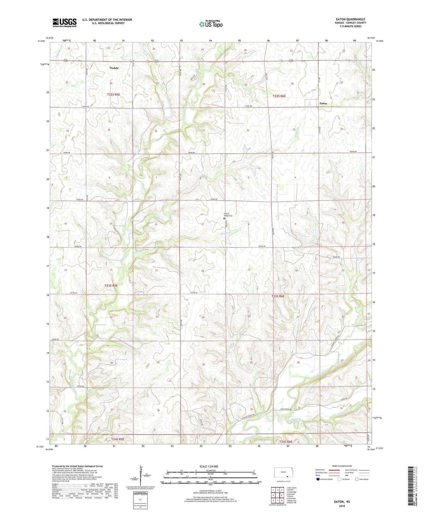
2022 topographic map quadrangle Eaton in the state of Kansas. Scale: 1:24000. Based on the newly updated USGS 7.5' US Topo map series, this map is in the following counties: Cowley. The map contains contour data, water features, and other items you are used to seeing on USGS maps, but also has updated roads and other features. This is the next generation of topographic maps. Printed on high-quality waterproof paper with UV fade-resistant inks.
Quads adjacent to this one:
West: Winfield
Northwest: New Salem
North: Burden
Northeast: Cambridge
East: Dexter
Southeast: Dexter SW
South: Maple City
Southwest: Silverdale
This map covers the same area as the classic USGS quad with code o37096b7.
Contains the following named places: Cabin Valley Oil Field, Cowley County, Crabb Creek, Deer Creek, Eaton, Eschs, Glenwood School, Harper Creek, Horse Creek, Maddox North Oil Field, Mount Knowledge School, Pebble Creek, Prairie Ridge Cemetery, Prairie Ridge School, Snake Creek, Tisdale, Tisdale United Methodist Church, Township of Liberty, Union Ridge School, Werner Oil Field, Wildcat Creek