MyTopo
Atlanta Kansas US Topo Map
Couldn't load pickup availability
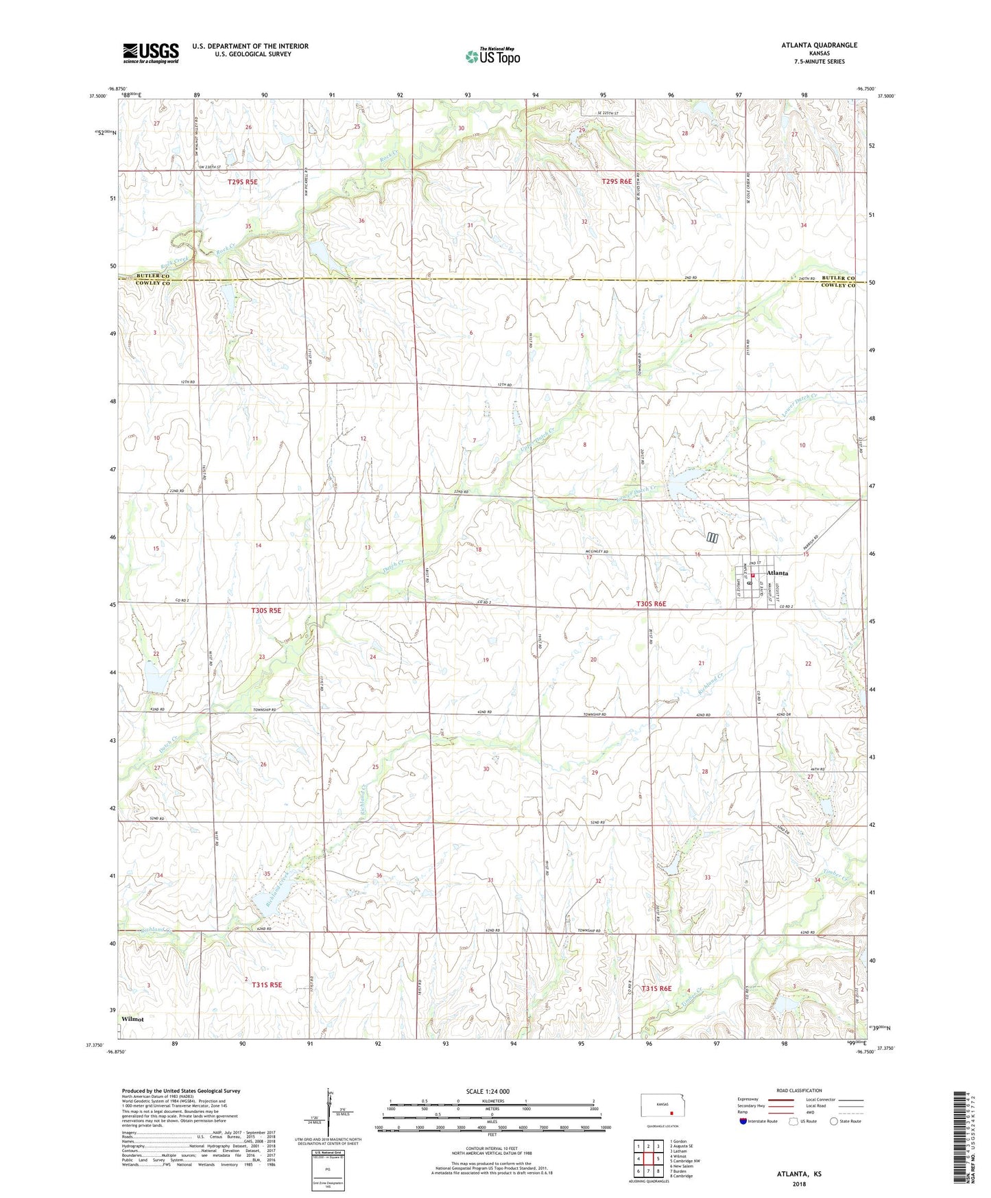
2022 topographic map quadrangle Atlanta in the state of Kansas. Scale: 1:24000. Based on the newly updated USGS 7.5' US Topo map series, this map is in the following counties: Cowley, Butler. The map contains contour data, water features, and other items you are used to seeing on USGS maps, but also has updated roads and other features. This is the next generation of topographic maps. Printed on high-quality waterproof paper with UV fade-resistant inks.
Quads adjacent to this one:
West: Wilmot
Northwest: Gordon
North: Augusta SE
Northeast: Latham
East: Cambridge NW
Southeast: Cambridge
South: Burden
Southwest: New Salem
This map covers the same area as the classic USGS quad with code o37096d7.
Contains the following named places: Atlanta, Atlanta Christian Church, Atlanta Post Office, Atlanta Wastewater Treatment Plant, Cedar Fork, City of Atlanta, Clay Oil Field, Combs Northeast Oil Field, Couch Oil Field, Cowley County Fire District 2 Atlanta, Eastman Oil Field, Green Valley School, Lower Dutch Creek, Omnia School, Polo School, Prairie View Church, Summit School, Township of Omnia, Upper Dutch Creek, ZIP Code: 67008