MyTopo
Wilmot Kansas US Topo Map
Couldn't load pickup availability
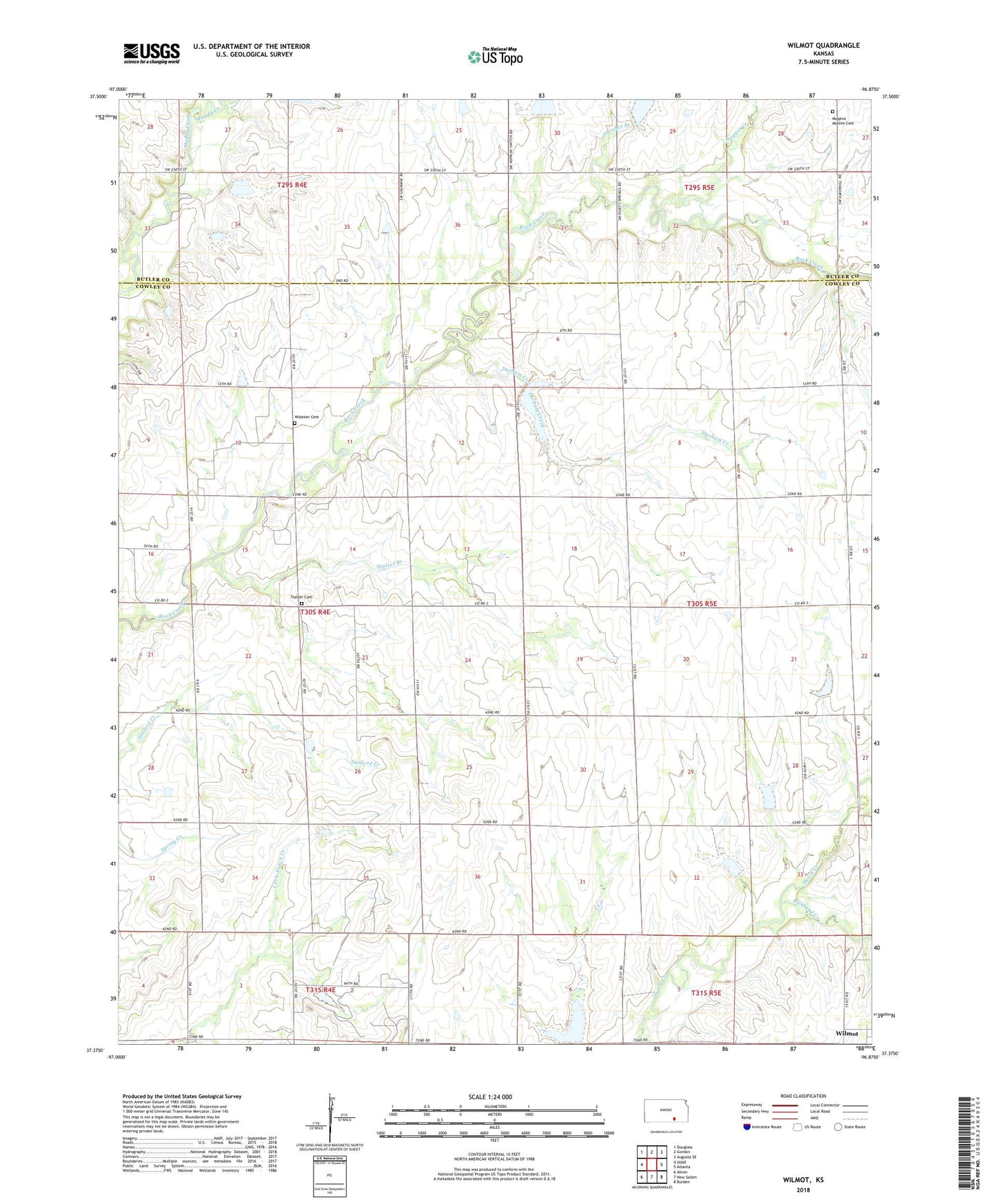
2022 topographic map quadrangle Wilmot in the state of Kansas. Scale: 1:24000. Based on the newly updated USGS 7.5' US Topo map series, this map is in the following counties: Cowley, Butler. The map contains contour data, water features, and other items you are used to seeing on USGS maps, but also has updated roads and other features. This is the next generation of topographic maps. Printed on high-quality waterproof paper with UV fade-resistant inks.
Quads adjacent to this one:
West: Udall
Northwest: Douglass
North: Gordon
Northeast: Augusta SE
East: Atlanta
Southeast: Burden
South: New Salem
Southwest: Akron
This map covers the same area as the classic USGS quad with code o37096d8.
Contains the following named places: Chigger Creek, Combs Oil Field, David Oil Field, Durham Creek, Eaton Acres Landing Strip, Green Valley Church, Mount Tabor Oil Field, Muqbra Muslim Cemetery, Prairie Grove School, Prairie View School, Richland Creek, Richland School, Rock Oil Field, Stalter Branch, Stalter Cemetery, Swisher Branch, Township of Richland, Township of Rock Creek, Widener Cemetery, Wilmot, ZIP Code: 67131