MyTopo
Burr Oak Kansas US Topo Map
Couldn't load pickup availability
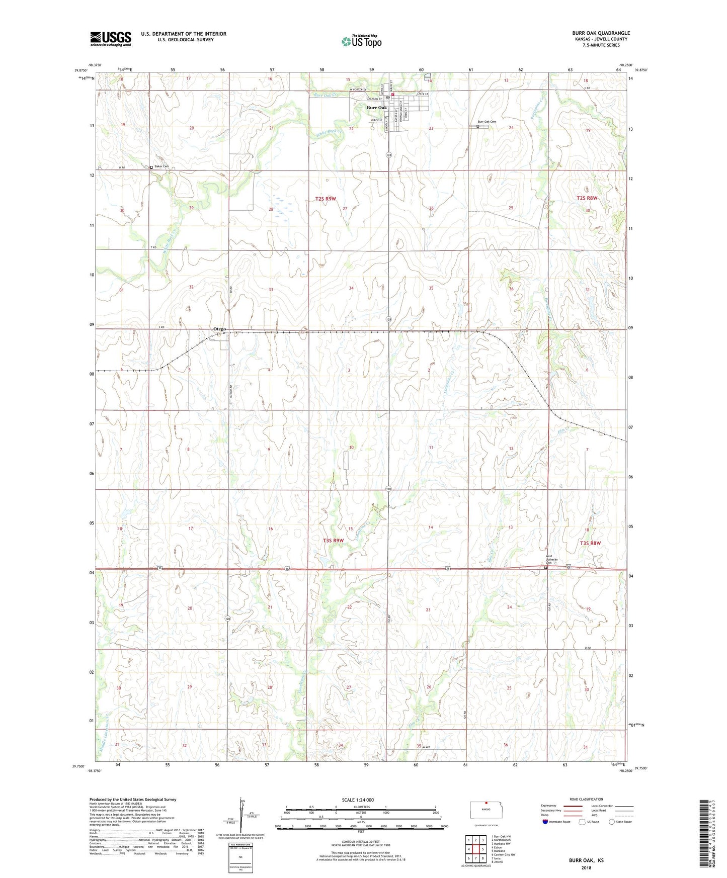
2022 topographic map quadrangle Burr Oak in the state of Kansas. Scale: 1:24000. Based on the newly updated USGS 7.5' US Topo map series, this map is in the following counties: Jewell. The map contains contour data, water features, and other items you are used to seeing on USGS maps, but also has updated roads and other features. This is the next generation of topographic maps. Printed on high-quality waterproof paper with UV fade-resistant inks.
Quads adjacent to this one:
West: Esbon
Northwest: Burr Oak NW
North: Northbranch
Northeast: Mankato NW
East: Mankato
Southeast: Jewell
South: Ionia
Southwest: Cawker City NW
This map covers the same area as the classic USGS quad with code o39098g3.
Contains the following named places: Baker Cemetery, Burr Oak, Burr Oak Cemetery, Burr Oak Community Library, Burr Oak Creek, Burr Oak High School, Burr Oak Post Office, Burr Oak Wastewater Plant, City of Burr Oak, Esbon Grain and Fertilizer Grain Elevator Number 2, Jewell County Rural Fire District 5, Midway Co - Operative Association Grain Elevator Number 5, Otego, Township of Burr Oak, Township of Limestone, West Lutheran Cemetery, White Rock Elementary School