MyTopo
Clay Center NE Kansas US Topo Map
Couldn't load pickup availability
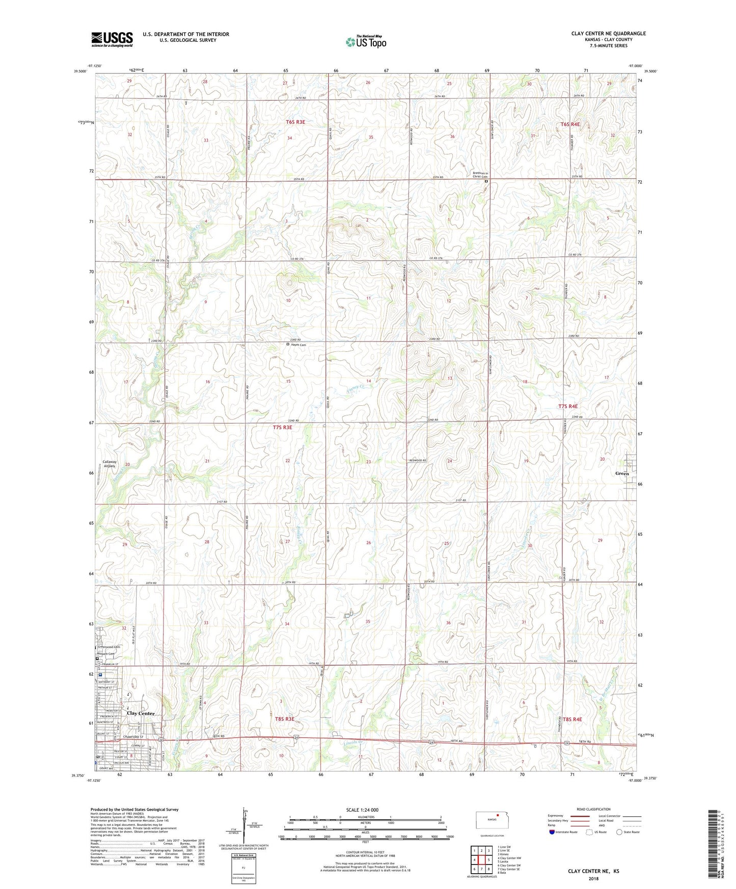
2022 topographic map quadrangle Clay Center NE in the state of Kansas. Scale: 1:24000. Based on the newly updated USGS 7.5' US Topo map series, this map is in the following counties: Clay. The map contains contour data, water features, and other items you are used to seeing on USGS maps, but also has updated roads and other features. This is the next generation of topographic maps. Printed on high-quality waterproof paper with UV fade-resistant inks.
Quads adjacent to this one:
West: Clay Center NW
Northwest: Linn SW
North: Linn SE
Northeast: Kimeo
East: Lasita
Southeast: Bala
South: Clay Center SE
Southwest: Clay Center SW
This map covers the same area as the classic USGS quad with code o39097d1.
Contains the following named places: Brethren in Christ Cemetery, Callaway Airpark, Clay Center, Clay Center Carnegie Library, Clay Center Christian Church, Clay Center Community High School, Clay Center Community Middle School, Clay Center Post Office, Clay Center Wesleyan Church, Clay County Medical Center, Clay County Museum, Evangelical Covenant Church of Clay Center, First Presbyterian Church, Green, Hawks Landing Mobile Home Park, Hayes Cemetery, Hayes United Methodist Church, Hebron Reformed Presbyterian Church, McKinley Middle School, Saint Paul Lutheran Church, Saint Paul's Episcopal Church, Saint Peter and Paul Catholic Church, Township of Hayes