MyTopo
Lasita Kansas US Topo Map
Couldn't load pickup availability
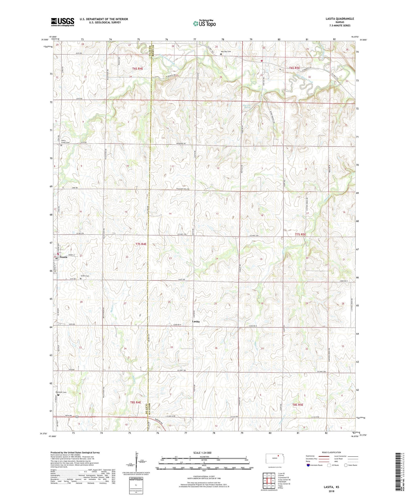
2022 topographic map quadrangle Lasita in the state of Kansas. Scale: 1:24000. Based on the newly updated USGS 7.5' US Topo map series, this map is in the following counties: Riley, Clay. The map contains contour data, water features, and other items you are used to seeing on USGS maps, but also has updated roads and other features. This is the next generation of topographic maps. Printed on high-quality waterproof paper with UV fade-resistant inks.
Quads adjacent to this one:
West: Clay Center NE
Northwest: Linn SE
North: Kimeo
Northeast: Greenleaf SE
East: Randolph
Southeast: Riley
South: Bala
Southwest: Clay Center SE
This map covers the same area as the classic USGS quad with code o39096d8.
Contains the following named places: Alert Covenant Church, City of Green, Ebenezer Cemetery, Ebenezer United Methodist Church, Fairview Elementary School, Fancy Creek, Fancy Creek Cemetery, Green Cemetery, Green Post Office, Green Rural Fire Department Station 1, Green United Methodist Church, Green Wastewater Plant, Lasita, May Day, May Day Cemetery, May Day Spring, North Fork Fancy Creek, Pleasant Hill School, Riley County Fire District 1 Station 7, Township of Center, Township of Fancy Creek, Township of Highland, West Fancy Creek, ZIP Code: 67447