MyTopo
Clifton Kansas US Topo Map
Couldn't load pickup availability
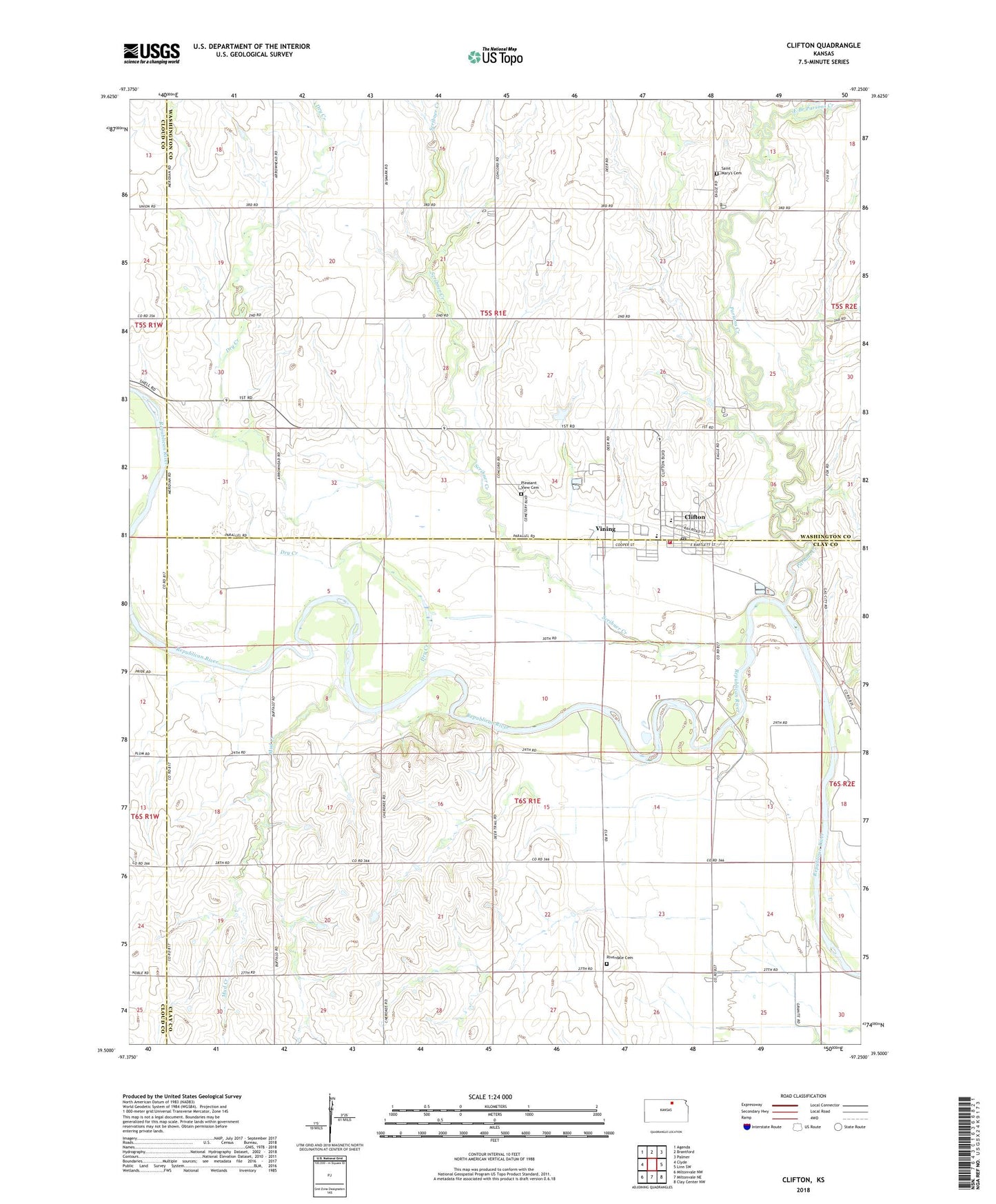
2022 topographic map quadrangle Clifton in the state of Kansas. Scale: 1:24000. Based on the newly updated USGS 7.5' US Topo map series, this map is in the following counties: Clay, Washington, Cloud. The map contains contour data, water features, and other items you are used to seeing on USGS maps, but also has updated roads and other features. This is the next generation of topographic maps. Printed on high-quality waterproof paper with UV fade-resistant inks.
Quads adjacent to this one:
West: Clyde
Northwest: Agenda
North: Brantford
Northeast: Palmer
East: Linn SW
Southeast: Clay Center NW
South: Miltonvale NE
Southwest: Miltonvale NW
This map covers the same area as the classic USGS quad with code o39097e3.
Contains the following named places: City of Clifton, City of Vining, Clifton, Clifton - Clyde Grade School, Clifton - Clyde Middle School, Clifton City Ambulance, Clifton City Hall, Clifton Community Historical Society Museum, Clifton Fire District 5, Clifton Post Office, Clifton Public Library, Clifton Sewer Treatment Plant, Dry Creek, East Branch Parsons Creek, Faith United Presbyterian Church, Mud Creek, Parsons Creek, Pleasant View Cemetery, Riverdale Cemetery, Saint Marys Catholic Church, Saint Marys Cemetery, Scribner Creek, Township of Clifton, Township of Mulberry, Vining, West Branch Scribner Creek, ZIP Code: 66937