MyTopo
Palmer Kansas US Topo Map
Couldn't load pickup availability
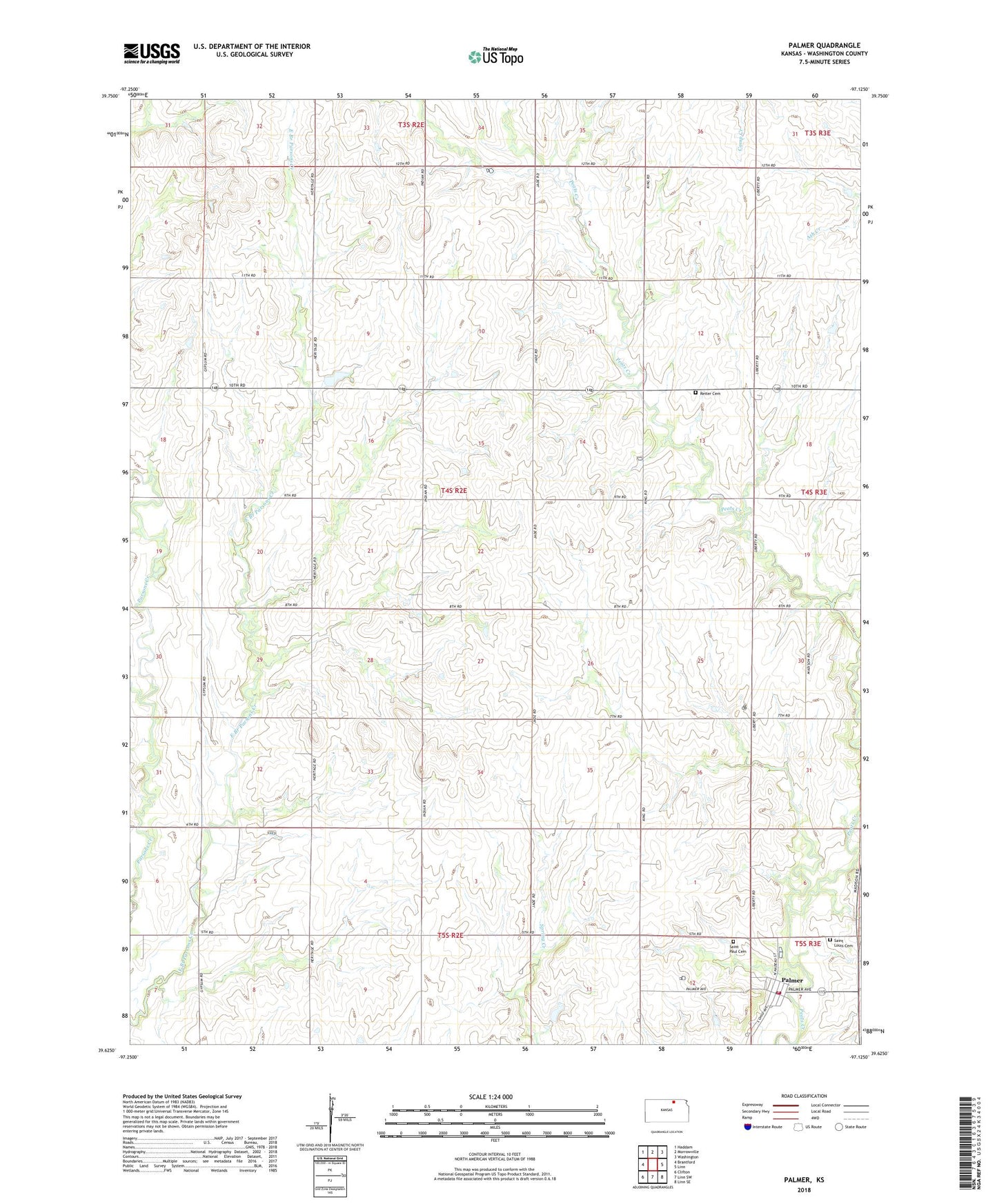
2022 topographic map quadrangle Palmer in the state of Kansas. Scale: 1:24000. Based on the newly updated USGS 7.5' US Topo map series, this map is in the following counties: Washington. The map contains contour data, water features, and other items you are used to seeing on USGS maps, but also has updated roads and other features. This is the next generation of topographic maps. Printed on high-quality waterproof paper with UV fade-resistant inks.
Quads adjacent to this one:
West: Brantford
Northwest: Haddam
North: Morrowville
Northeast: Washington
East: Linn
Southeast: Linn SE
South: Linn SW
Southwest: Clifton
This map covers the same area as the classic USGS quad with code o39097f2.
Contains the following named places: City of Palmer, Immanuel Lutheran Church, Immanuel School, Palmer, Palmer Grain Elevator Number 1, Palmer Post Office, Palmer Wastewater Plant, Reiter Cemetery, Saint Louis Cemetery, Saint Paul Cemetery, Township of Strawberry, Washington County Fire District 4