MyTopo
Copeland Kansas US Topo Map
Couldn't load pickup availability
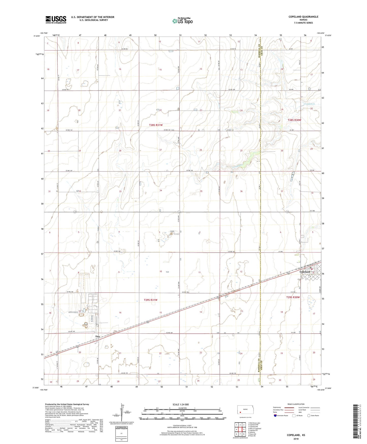
2022 topographic map quadrangle Copeland in the state of Kansas. Scale: 1:24000. Based on the newly updated USGS 7.5' US Topo map series, this map is in the following counties: Haskell, Gray. The map contains contour data, water features, and other items you are used to seeing on USGS maps, but also has updated roads and other features. This is the next generation of topographic maps. Printed on high-quality waterproof paper with UV fade-resistant inks.
Quads adjacent to this one:
West: West of Copeland
Northwest: Wild Horse Lake
North: Copeland NW
Northeast: Copeland NE
East: Copeland SE
Southeast: Plains NE
South: Plains NW
Southwest: Sublette
This map covers the same area as the classic USGS quad with code o37100e6.
Contains the following named places: City of Copeland, Copeland, Copeland Christian Church, Copeland City Hall, Copeland Elementary School, Copeland Fire Department, Copeland Post Office, Copeland Public Library, Copeland Santa Fe Senior Center, Copeland Untied Methodist Church, South Gray Junior High School, Tice, Township of Lockport, ZIP Code: 67837