MyTopo
Sublette Kansas US Topo Map
Couldn't load pickup availability
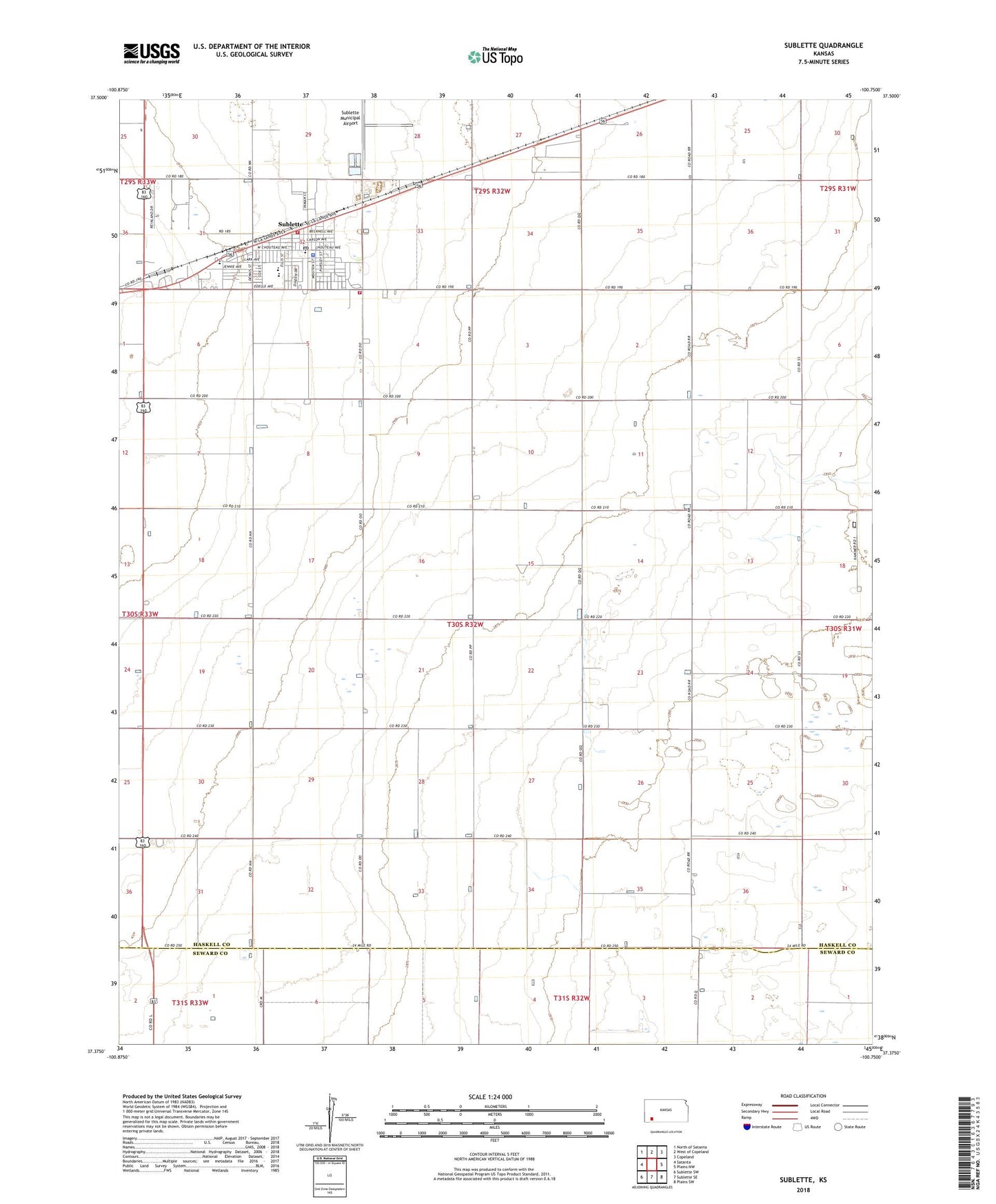
2022 topographic map quadrangle Sublette in the state of Kansas. Scale: 1:24000. Based on the newly updated USGS 7.5' US Topo map series, this map is in the following counties: Haskell, Seward. The map contains contour data, water features, and other items you are used to seeing on USGS maps, but also has updated roads and other features. This is the next generation of topographic maps. Printed on high-quality waterproof paper with UV fade-resistant inks.
Quads adjacent to this one:
West: Satanta
Northwest: North of Satanta
North: West of Copeland
Northeast: Copeland
East: Plains NW
Southeast: Plains SW
South: Sublette SE
Southwest: Sublette SW
This map covers the same area as the classic USGS quad with code o37100d7.
Contains the following named places: City of Sublette, Crosswalk Christian School, Gospel Menonite Church, Haskel County Fairgrounds, Haskell County Ambulance Service, Haskell County Courthouse, Haskell County Health Department, Haskell County Historical Museum, Haskell County Landfill, Haskell County Sheriff's Office, Haskell Township and Sublette Fire Department, Haskell Township Library, Loco, McCoy Grain Company Grain Elevator Number 1, Natural Resources Conservation Service Sublette Service Center, New Covenant Fellowship, Sublette, Sublette Christian Church, Sublette Church of Christ, Sublette Church of the Nazerene, Sublette Elementary School, Sublette Fire Department, Sublette High School, Sublette Middle School, Sublette Municipal Airport, Sublette Post Office, Sublette Southern Baptist Church, Sublette United Methodist Church, Sublette Wastewater Plant, Western Lark Trailer Park