MyTopo
Denton Kansas US Topo Map
Couldn't load pickup availability
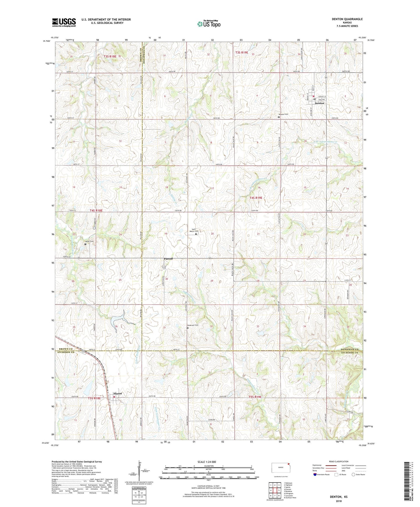
2022 topographic map quadrangle Denton in the state of Kansas. Scale: 1:24000. Based on the newly updated USGS 7.5' US Topo map series, this map is in the following counties: Doniphan, Atchison, Brown. The map contains contour data, water features, and other items you are used to seeing on USGS maps, but also has updated roads and other features. This is the next generation of topographic maps. Printed on high-quality waterproof paper with UV fade-resistant inks.
Quads adjacent to this one:
West: Everest
Northwest: Robinson
North: Highland
Northeast: Sparks
East: Bendena
Southeast: Atchison West
South: Lancaster
Southwest: Effingham
This map covers the same area as the classic USGS quad with code o39095f3.
Contains the following named places: Agricultural Partners Co - Operative Grain Elevator Number 2, Anderson Cemetery, Atchison County Fire District 5 - Huron, City of Denton, City of Huron, Darwin, Denton, Denton Cemetery, Denton Post Office, Denton United Methodist Church, Denton Wastewater Plant, Doniphan County Fire District 3 Denton, Eden, High Prairie School, Huron, Huron Wastewater Treatment Plant, KAIR - FM (Atchison), Lancaster United Methodist Church, Miller Cemetery, Mount Vernon School, Normanville, Normile School, Purcell, Purcell School, Saint Mary's Cemetery, Star School, Township of Union, ZIP Code: 66017