MyTopo
Robinson Kansas US Topo Map
Couldn't load pickup availability
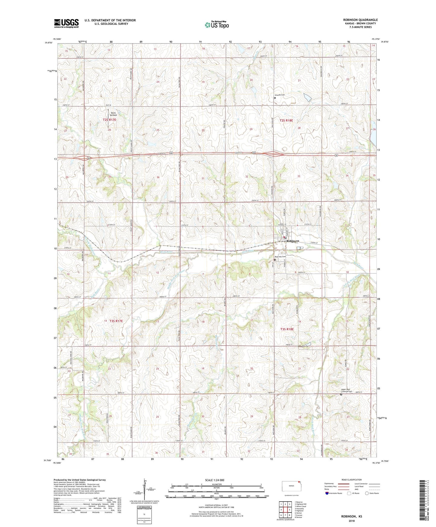
2022 topographic map quadrangle Robinson in the state of Kansas. Scale: 1:24000. Based on the newly updated USGS 7.5' US Topo map series, this map is in the following counties: Brown. The map contains contour data, water features, and other items you are used to seeing on USGS maps, but also has updated roads and other features. This is the next generation of topographic maps. Printed on high-quality waterproof paper with UV fade-resistant inks.
Quads adjacent to this one:
West: Hiawatha
Northwest: Reserve
North: Highland NW
Northeast: White Cloud
East: Highland
Southeast: Denton
South: Everest
Southwest: Horton
This map covers the same area as the classic USGS quad with code o39095g4.
Contains the following named places: Agricultural Partners Co - Operative Grain Elevator Number 7, Belleview School, Brown County State Lake Dam, Brown County State Park, Brown State Fishing Lake and Wildlife Area, Buttermilk Creek, City of Robinson, Davis Airfield, Hazel Creek, Klinefelter Creek, La Grange School, Middle Fork Wolf River, North Fork Wolf River, Prairie Springs School, Robinson, Robinson City Hall, Robinson Fire Department, Robinson Middle School, Robinson Post Office, Robinson Senior Citizens Center, Robinson United Methodist Church, Robinson Wastewater Treatment Plant, Rose Hill Cemetery, Seward, South Fork Wolf River, Township of Hiawatha, Township of Robinson, Ununda Cemetery, Upper Wolf Lutheran Cemetery, Upper Wolf Lutheran Church, ZIP Code: 66532