MyTopo
Ellis SE Kansas US Topo Map
Couldn't load pickup availability
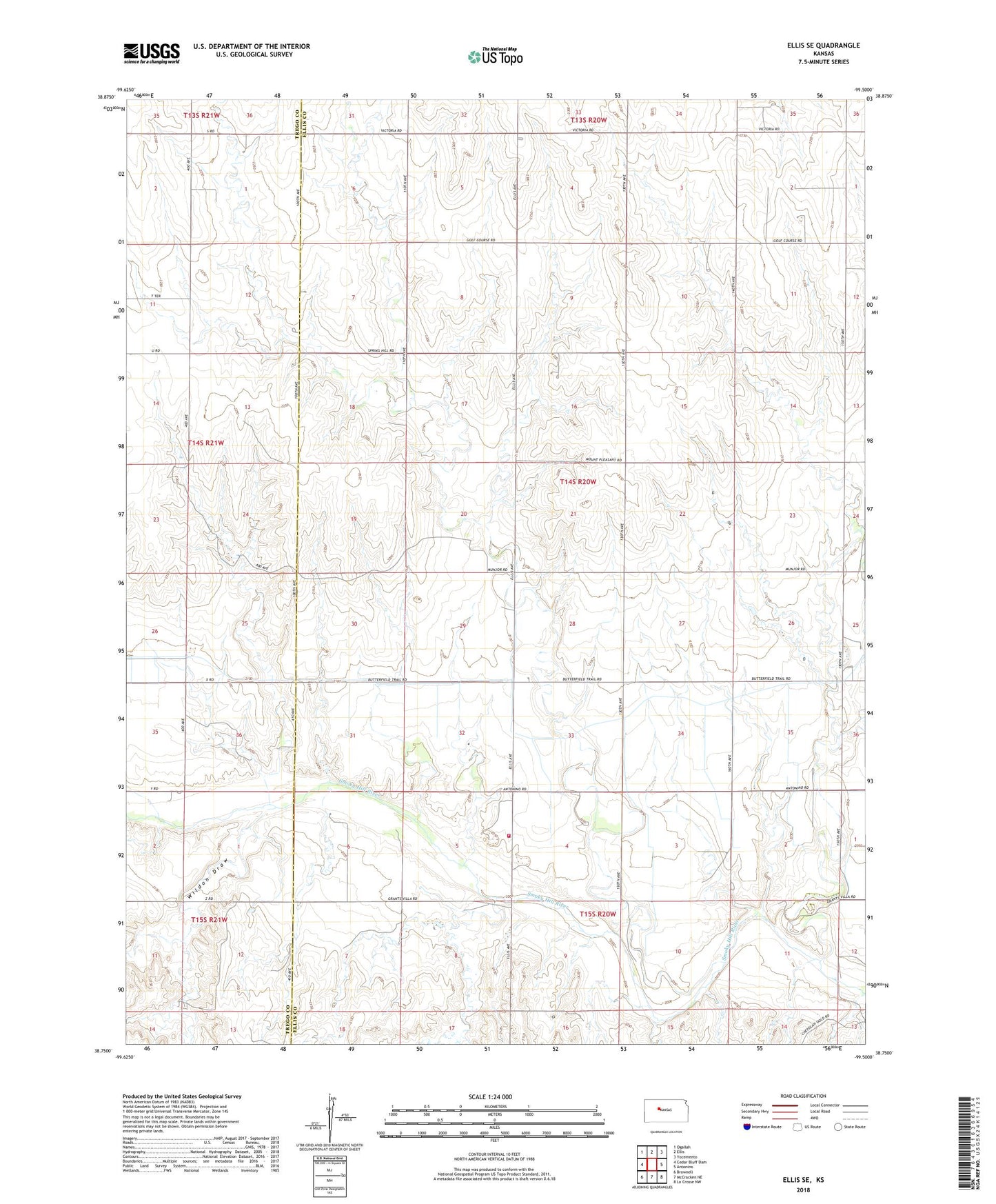
2022 topographic map quadrangle Ellis SE in the state of Kansas. Scale: 1:24000. Based on the newly updated USGS 7.5' US Topo map series, this map is in the following counties: Ellis, Trego. The map contains contour data, water features, and other items you are used to seeing on USGS maps, but also has updated roads and other features. This is the next generation of topographic maps. Printed on high-quality waterproof paper with UV fade-resistant inks.
Quads adjacent to this one:
West: Cedar Bluff Dam
Northwest: Ogallah
North: Ellis
Northeast: Yocemento
East: Antonino
Southeast: La Crosse NW
South: McCracken NE
Southwest: Brownell
This map covers the same area as the classic USGS quad with code o38099g5.
Contains the following named places: Cedar Bluff Canal, Elk Creek, Ellis County Rural Fire Department 7, Pleasant West Oil Field, Rohr Jacobs Lake, Solburn Oil Field, Wildon Draw