MyTopo
Emporia SE Kansas US Topo Map
Couldn't load pickup availability
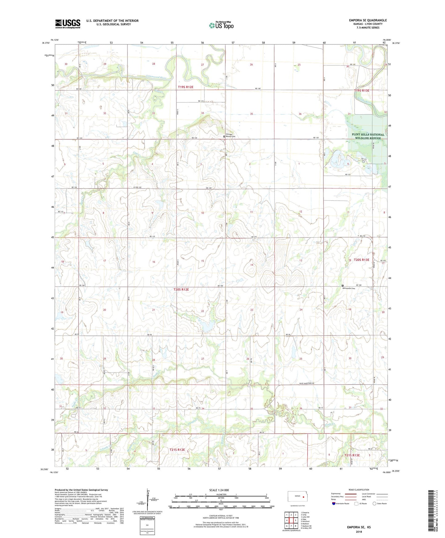
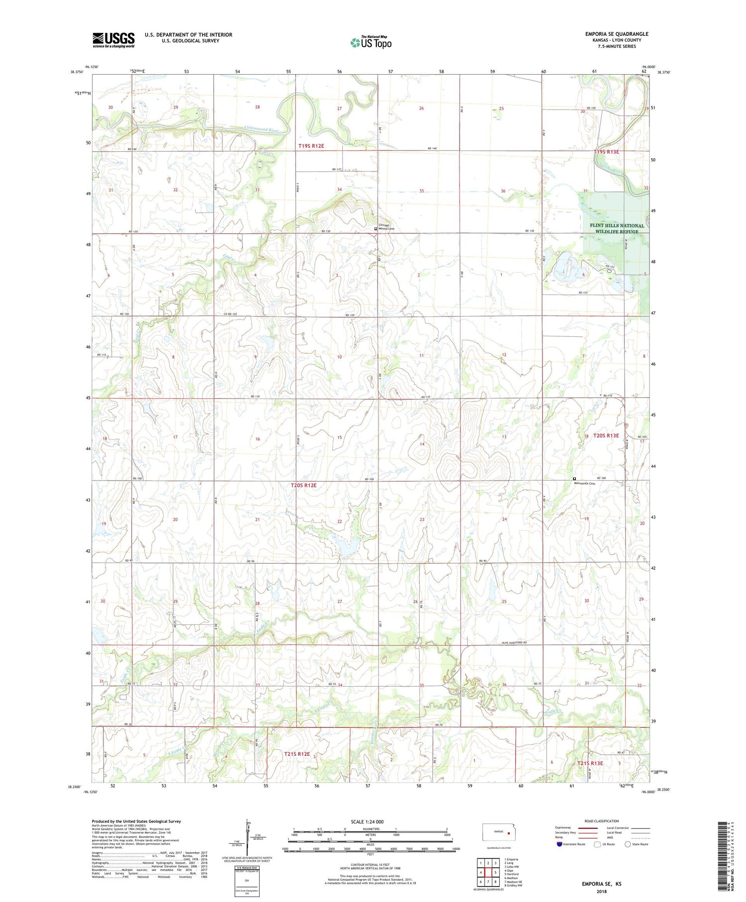
2022 topographic map quadrangle Emporia SE in the state of Kansas. Scale: 1:24000. Based on the newly updated USGS 7.5' US Topo map series, this map is in the following counties: Lyon. The map contains contour data, water features, and other items you are used to seeing on USGS maps, but also has updated roads and other features. This is the next generation of topographic maps. Printed on high-quality waterproof paper with UV fade-resistant inks.
Quads adjacent to this one:
West: Olpe
Northwest: Emporia
North: Lang
Northeast: Lebo NW
East: Hartford
Southeast: Gridley NW
South: Madison NE
Southwest: Madison
This map covers the same area as the classic USGS quad with code o38096c1.
Contains the following named places: Chicago Mound Cemetery, Coal Creek, Dry Creek, Gardner Farms, Haag Farms, Harper Creek, Hoosier Creek, KANH - FM (Emporia), KVoe - FM (Emporia), Lazy H Farms, Mautz Farm, Mennonite Cemetery, South Eagle Creek, Twin Mounds Church, Wyckoff