MyTopo
Madison Kansas US Topo Map
Couldn't load pickup availability
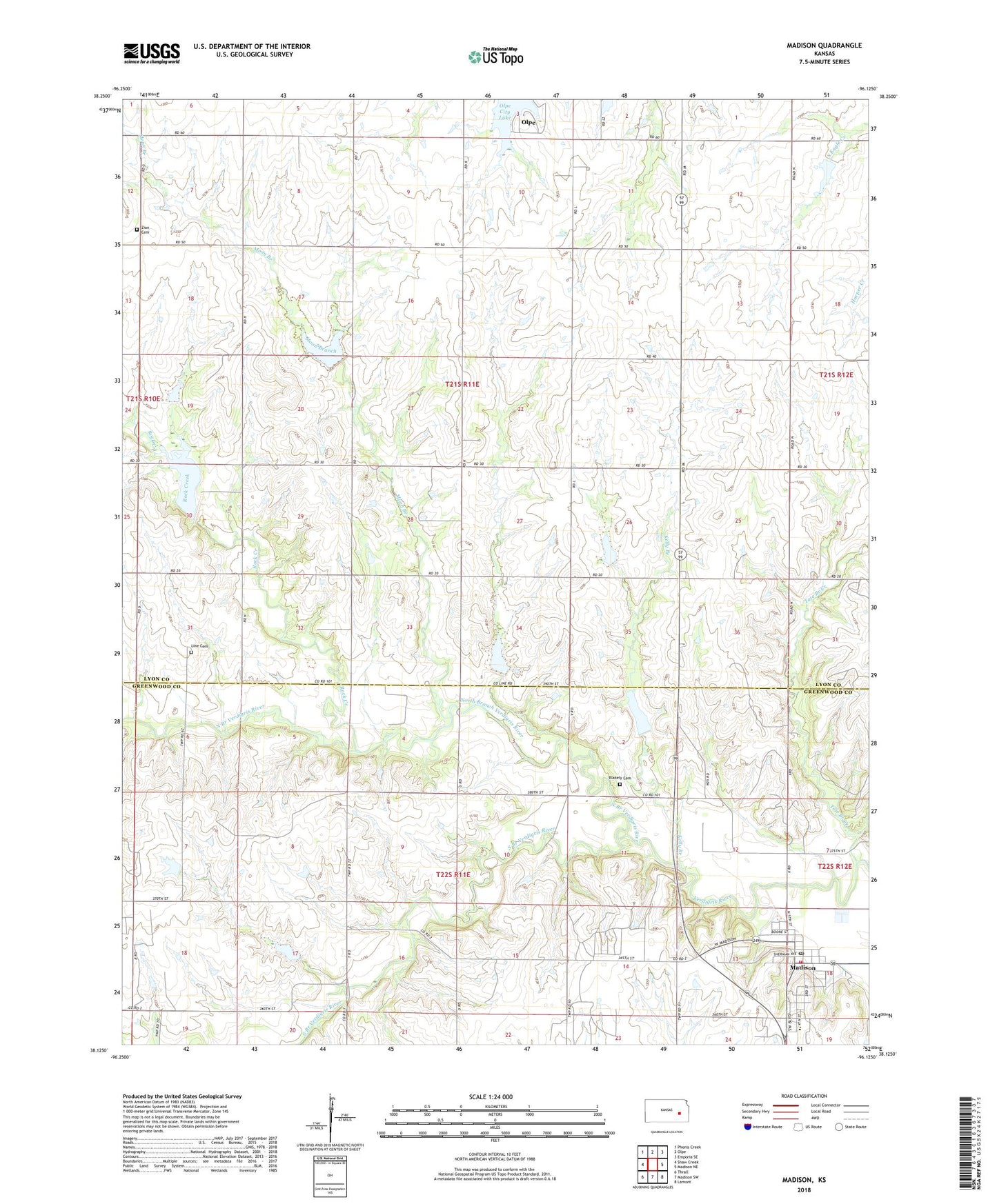
2022 topographic map quadrangle Madison in the state of Kansas. Scale: 1:24000. Based on the newly updated USGS 7.5' US Topo map series, this map is in the following counties: Lyon, Greenwood. The map contains contour data, water features, and other items you are used to seeing on USGS maps, but also has updated roads and other features. This is the next generation of topographic maps. Printed on high-quality waterproof paper with UV fade-resistant inks.
Quads adjacent to this one:
West: Shaw Creek
Northwest: Phenis Creek
North: Olpe
Northeast: Emporia SE
East: Madison NE
Southeast: Lamont
South: Madison SW
Southwest: Thrall
This map covers the same area as the classic USGS quad with code o38096b2.
Contains the following named places: Blakely Cemetery, Central Christian Church, City of Madison, EMCH Feed and Elevator Company Grain Elevator Number 1, First Baptist Church, First Christian Church, First Presbyterian Church, Gloria's Ranch, Kelly Branch, Line Cemetery, Madison, Madison City Hall, Madison Elementary School, Madison Post Office, Madison Public Library, Madison Rural Fire Department, Madison Senior Center, Madison United Methodist Church, Madison Volunteer Fire Department, Madison Wastewater Treatment Facility, Moon Branch, North Branch Verdigris River, Olpe City Lake, Rock Creek, Saint Teresa of Avila Catholic Church, South Branch Verdigris River, Tate Branch Creek, Township of Center, Verdigris, Verdigris Church, Zion Cemetery, ZIP Code: 66860