MyTopo
Eskridge Kansas US Topo Map
Couldn't load pickup availability
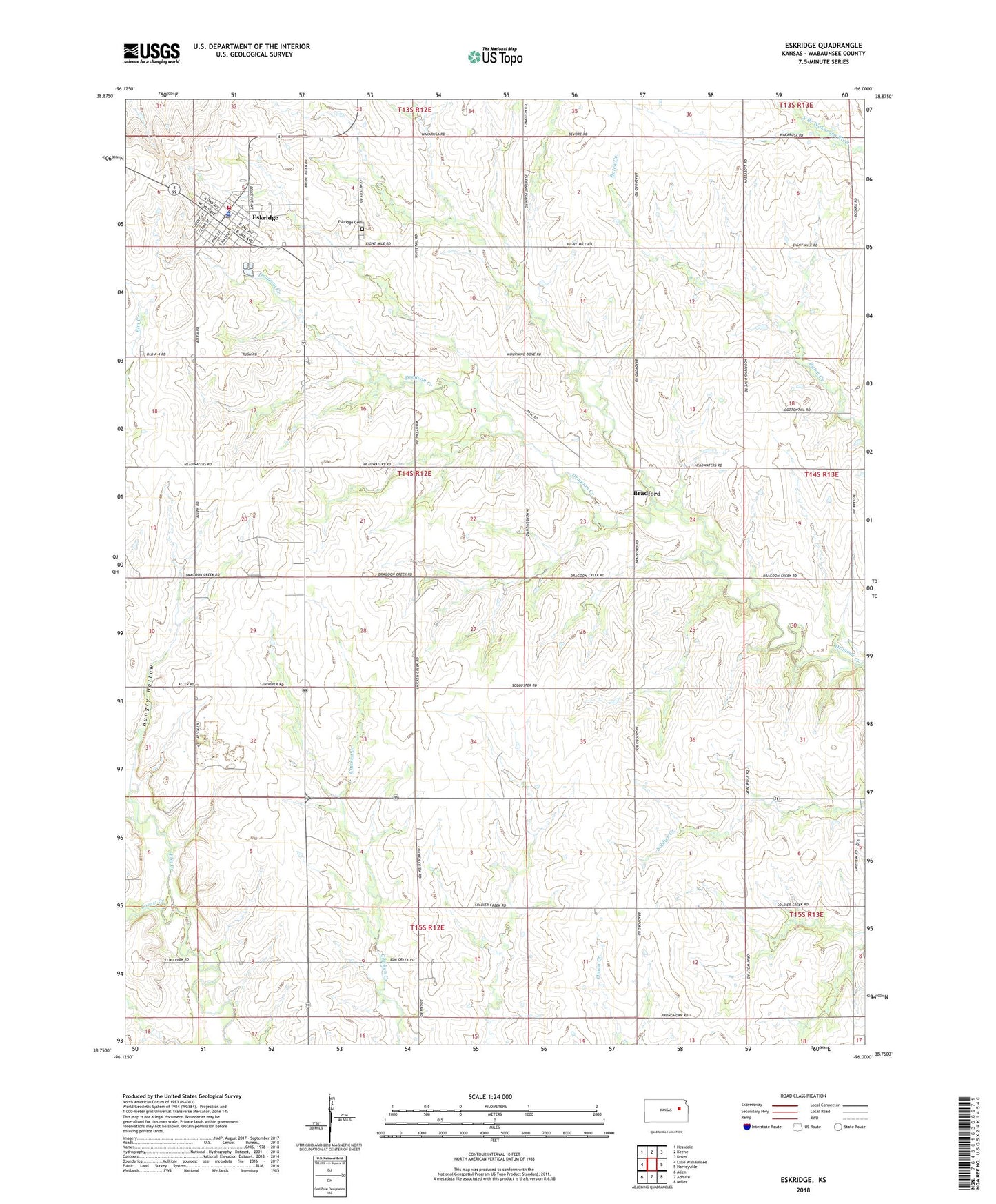
2022 topographic map quadrangle Eskridge in the state of Kansas. Scale: 1:24000. Based on the newly updated USGS 7.5' US Topo map series, this map is in the following counties: Wabaunsee. The map contains contour data, water features, and other items you are used to seeing on USGS maps, but also has updated roads and other features. This is the next generation of topographic maps. Printed on high-quality waterproof paper with UV fade-resistant inks.
Quads adjacent to this one:
West: Lake Wabaunsee
Northwest: Hessdale
North: Keene
Northeast: Dover
East: Harveyville
Southeast: Miller
South: Admire
Southwest: Allen
This map covers the same area as the classic USGS quad with code o38096g1.
Contains the following named places: American Medical Response Eskridge, Bradford, City of Eskridge, Eskridge, Eskridge Cemetery, Eskridge City Hall, Eskridge Police Department, Eskridge Post Office, Eskridge Senior Center, Eskridge Southern Baptist Church, Eskridge United Methodist Church, Eskridge Wastewater Treatment Plant, First United Presbyterian Church, Hungry Hollow, Locust Creek, Mission Valley High School, Mission Valley School District Office, Pottawatomie Wabaunsee Regional Library Eskridge Branch, Township of Wilmington, Wabaunsee County Fire District 5, ZIP Code: 66431