MyTopo
Harveyville Kansas US Topo Map
Couldn't load pickup availability
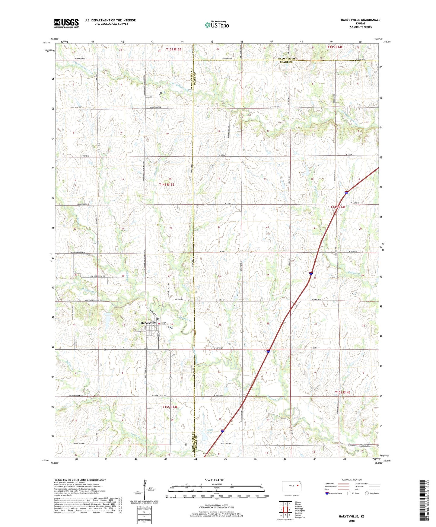
2022 topographic map quadrangle Harveyville in the state of Kansas. Scale: 1:24000. Based on the newly updated USGS 7.5' US Topo map series, this map is in the following counties: Osage, Wabaunsee, Shawnee. The map contains contour data, water features, and other items you are used to seeing on USGS maps, but also has updated roads and other features. This is the next generation of topographic maps. Printed on high-quality waterproof paper with UV fade-resistant inks.
Quads adjacent to this one:
West: Eskridge
Northwest: Keene
North: Dover
Northeast: Auburn
East: Burlingame
Southeast: Osage City
South: Miller
Southwest: Admire
This map covers the same area as the classic USGS quad with code o38095g8.
Contains the following named places: Batch Creek, Bellview School, City of Harveyville, Coon Creek, Grandview, Harveyville, Harveyville Elementary School, Harveyville Post Office, Harveyville Sewer Treatment Plant, Harveyville United Methodist Church, Pottawatomie Wabaunsee Regional Library Harveyville Mini Branch, Sharon School, Smith Lake, Township of Plumb, Wabaunsee County Fire District 3, ZIP Code: 66413