MyTopo
Goff Kansas US Topo Map
Couldn't load pickup availability
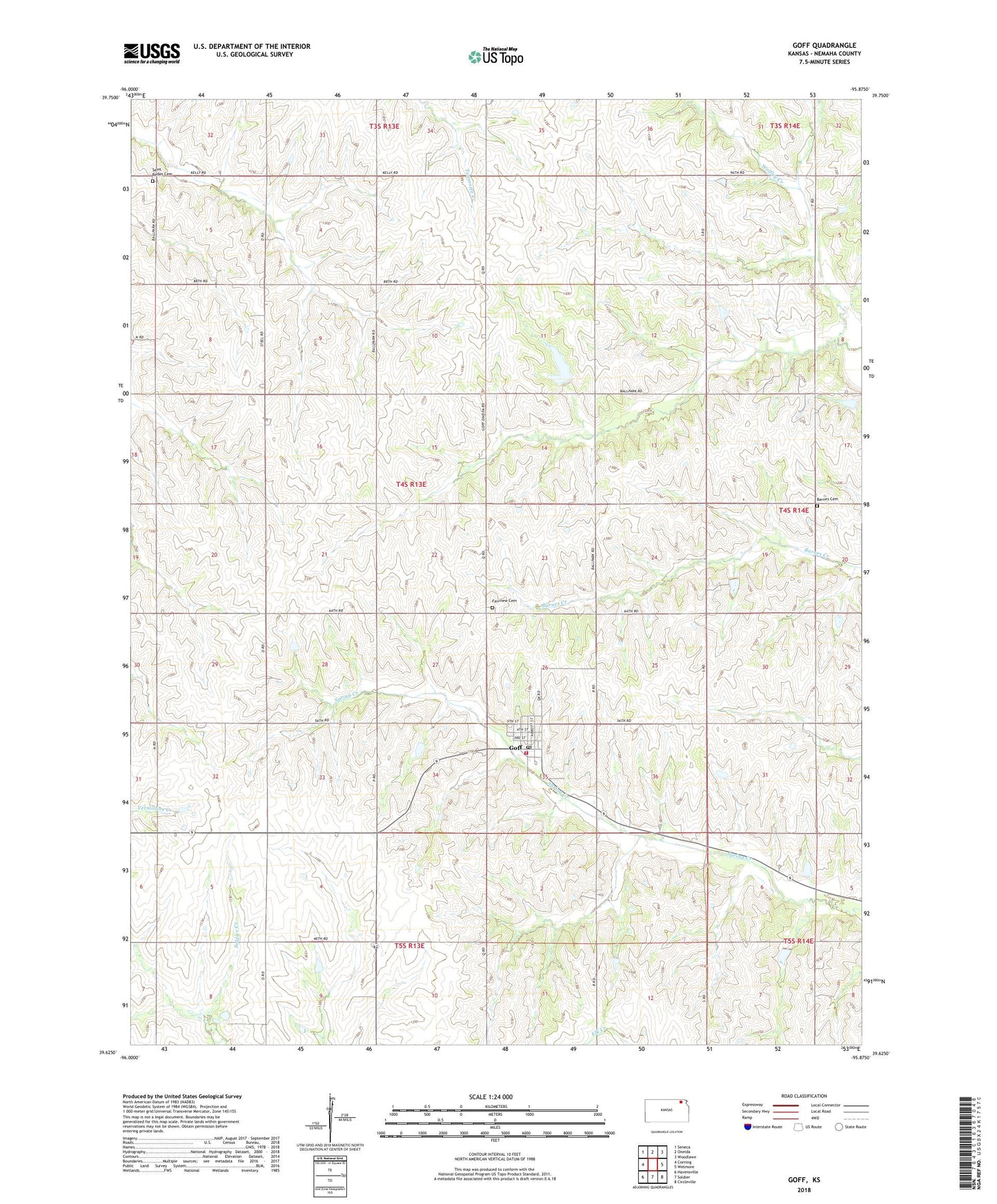
2022 topographic map quadrangle Goff in the state of Kansas. Scale: 1:24000. Based on the newly updated USGS 7.5' US Topo map series, this map is in the following counties: Nemaha. The map contains contour data, water features, and other items you are used to seeing on USGS maps, but also has updated roads and other features. This is the next generation of topographic maps. Printed on high-quality waterproof paper with UV fade-resistant inks.
Quads adjacent to this one:
West: Corning
Northwest: Seneca
North: Oneida
Northeast: Woodlawn
East: Wetmore
Southeast: Circleville
South: Soldier
Southwest: Havensville
This map covers the same area as the classic USGS quad with code o39095f8.
Contains the following named places: Barnes Cemetery, City of Goff, Fairview Cemetery, Goff, Goff Post Office, Goff United Methodist Church, Goff Wastewater Plant, Nemaha County Rural Fire District 1, Saint Bedes Cemetery, Township of Harrison, ZIP Code: 66428