MyTopo
Woodlawn Kansas US Topo Map
Couldn't load pickup availability
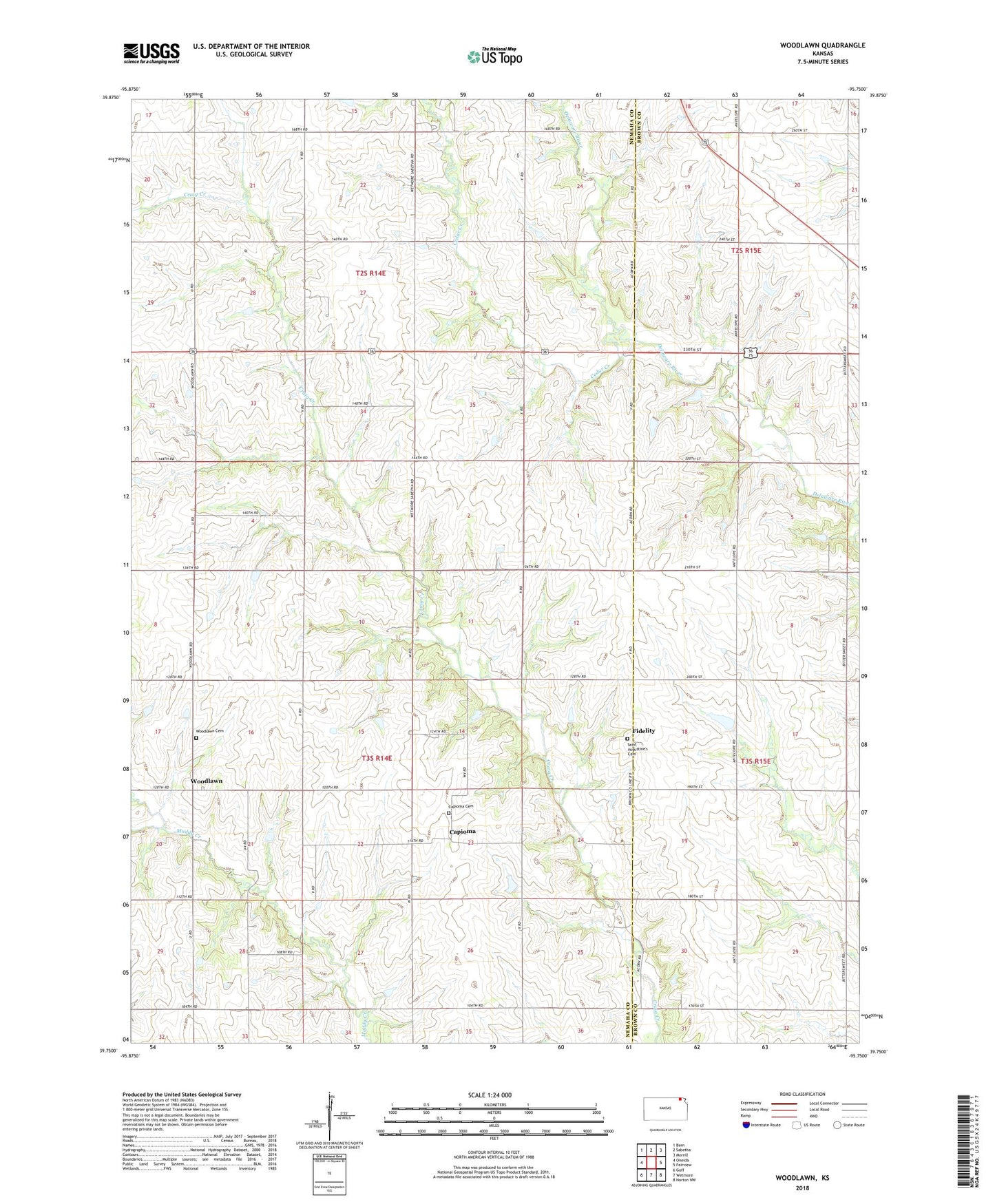
2022 topographic map quadrangle Woodlawn in the state of Kansas. Scale: 1:24000. Based on the newly updated USGS 7.5' US Topo map series, this map is in the following counties: Nemaha, Brown. The map contains contour data, water features, and other items you are used to seeing on USGS maps, but also has updated roads and other features. This is the next generation of topographic maps. Printed on high-quality waterproof paper with UV fade-resistant inks.
Quads adjacent to this one:
West: Oneida
Northwest: Bern
North: Sabetha
Northeast: Morrill
East: Fairview
Southeast: Horton NW
South: Wetmore
Southwest: Goff
This map covers the same area as the classic USGS quad with code o39095g7.
Contains the following named places: Capioma, Capioma Cemetery, Cedar Creek, Fidelity, Fidelity Cemetery, Fidelity Church, Kansas Department of Transportation Brown County Rest Area, Township of Capioma, Township of Rock Creek, Woodlawn, Woodlawn Cemetery