MyTopo
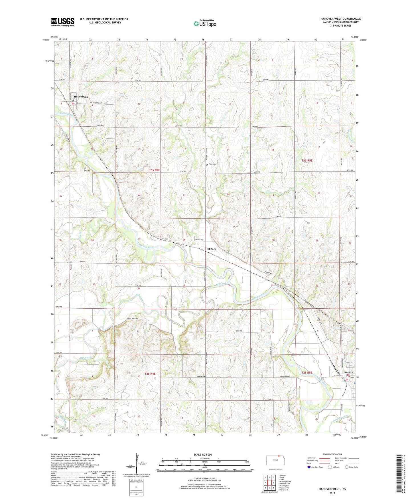
Hanover West Kansas US Topo Map
Couldn't load pickup availability
2022 topographic map quadrangle Hanover West in the state of Kansas. Scale: 1:24000. Based on the newly updated USGS 7.5' US Topo map series, this map is in the following counties: Washington. The map contains contour data, water features, and other items you are used to seeing on USGS maps, but also has updated roads and other features. This is the next generation of topographic maps. Printed on high-quality waterproof paper with UV fade-resistant inks.
Quads adjacent to this one:
West: Washington NE
Northwest: Endicott
North: Diller
Northeast: Odell
East: Hanover East
Southeast: Hanover SE
South: Hanover SW
Southwest: Washington
This map covers the same area as the classic USGS quad with code o39096h8.
Contains the following named places: City of Hanover, City of Hollenberg, Coufal-Warren Airport, Country Acres Trailer Court, Hanover, Hanover Hospital, Hanover Post Office, Hanover Rural Fire Department District 10, Hanover Wastewater Plant, Hollenberg, Hollenberg Fire District 10, Hollenberg Post Office, Joy Creek, Mill Creek, Prall Cemetery, Spence, Township of Franklin, Wasseman Farms Airport, ZIP Code: 66945