MyTopo
Odell Nebraska US Topo Map
Couldn't load pickup availability
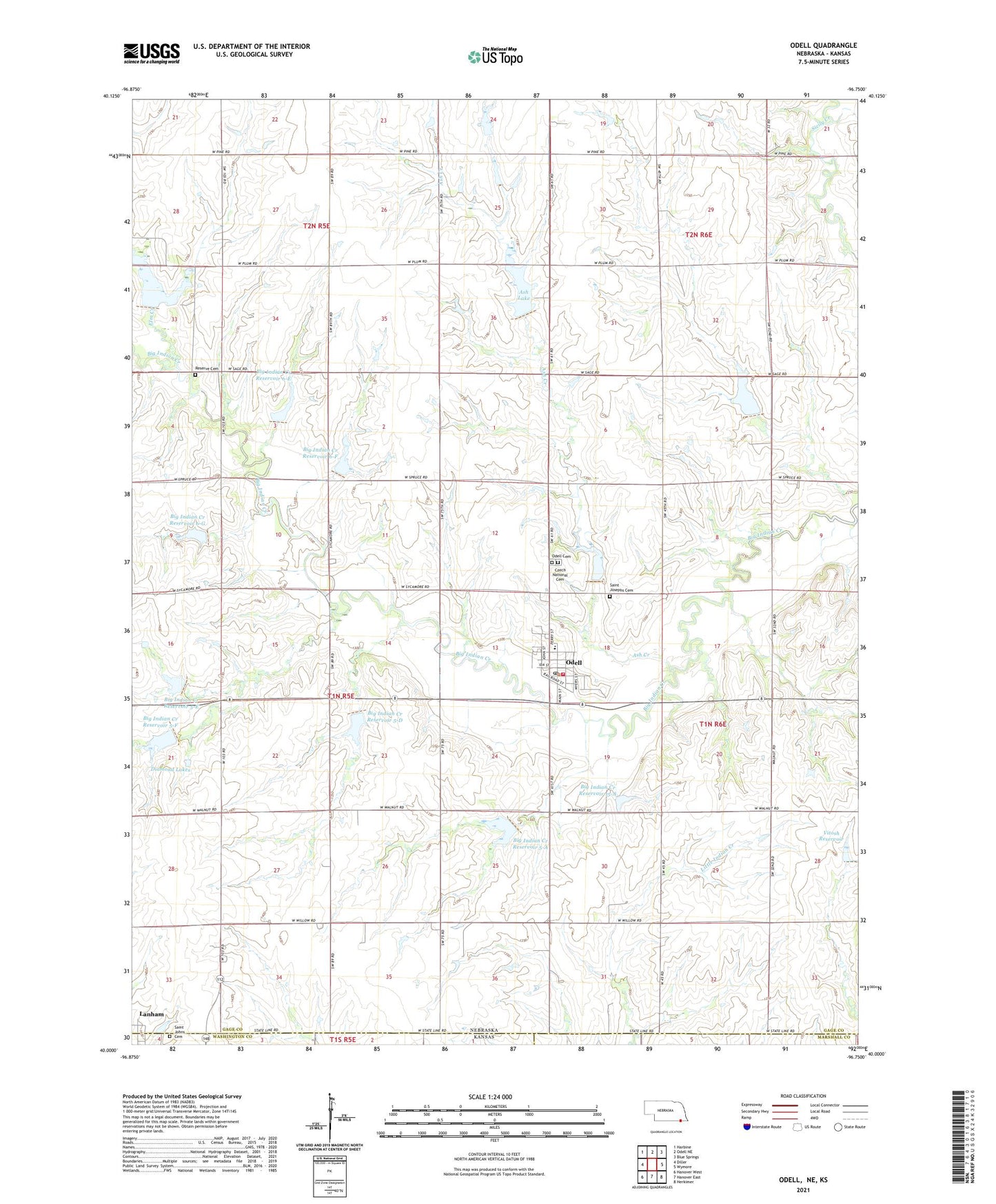
2021 topographic map quadrangle Odell in the states of Nebraska, Kansas. Scale: 1:24000. Based on the newly updated USGS 7.5' US Topo map series, this map is in the following counties: Gage, Washington, Marshall. The map contains contour data, water features, and other items you are used to seeing on USGS maps, but also has updated roads and other features. This is the next generation of topographic maps. Printed on high-quality waterproof paper with UV fade-resistant inks.
Quads adjacent to this one:
West: Diller
Northwest: Harbine
North: Odell NE
Northeast: Blue Springs
East: Wymore
Southeast: Herkimer
South: Hanover East
Southwest: Hanover West
This map covers the same area as the classic USGS quad with code o40096a7.
Contains the following named places: Arrowhead Lake, Arrowhead State Wildlife Management Area, Ash Creek, Ash Lake, Big Indian Creek Dam 15-A, Big Indian Creek Dam 15-B, Big Indian Creek Dam 16-C, Big Indian Creek Dam 3-A, Big Indian Creek Dam 5-A, Big Indian Creek Dam 5-D, Big Indian Creek Dam 5-E, Big Indian Creek Dam 5-F, Big Indian Creek Dam 6-E, Big Indian Creek Dam 6-F, Big Indian Creek Dam 6-G, Big Indian Creek Reservoir 15-A, Big Indian Creek Reservoir 15-B, Big Indian Creek Reservoir 5-A, Big Indian Creek Reservoir 5-D, Big Indian Creek Reservoir 5-E, Big Indian Creek Reservoir 5-F, Big Indian Creek Reservoir 6-E, Big Indian Creek Reservoir 6-F, Big Indian Creek Reservoir 6-G, Church of Christ, Czech National Cemetery, Diamond Lake State Wildlife Management Area, Diamond Lakes, Elm Creek, Farmers Co-operative Elevator, Indian Creek Reservoir 3-A, Lanham, Odell, Odell Cemetery, Odell Post Office, Odell Public Schools, Odell Volunteer Fire Department, Our Saviours Lutheran Church, Reserve Cemetery, Saint Johns Cemetery, Saint Josephs Cemetery, Saint Marys Church, Township of Glenwood, Village of Odell, Vitosh Dam, ZIP Code: 68415