MyTopo
Hardtner Kansas US Topo Map
Couldn't load pickup availability
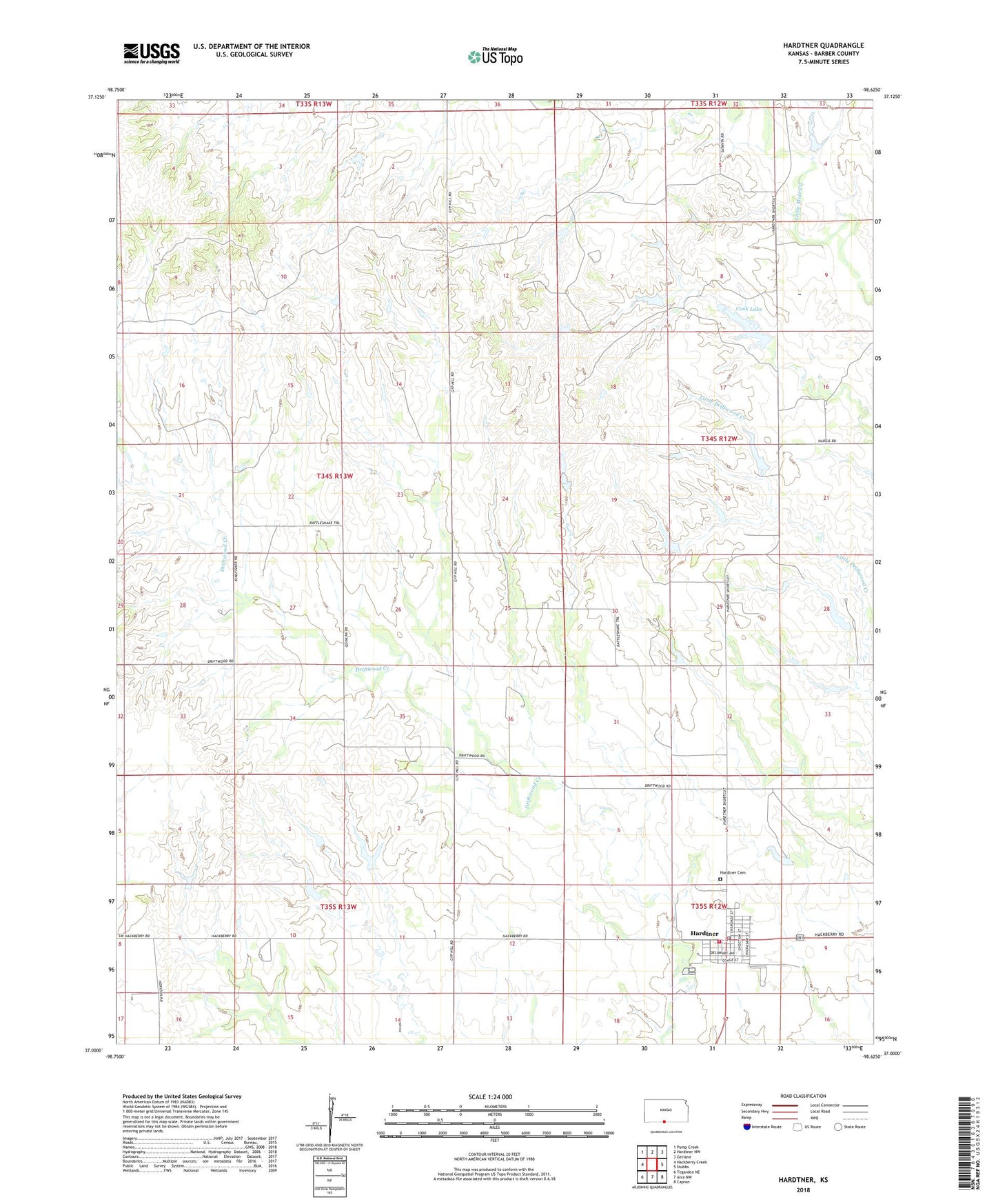
2022 topographic map quadrangle Hardtner in the state of Kansas. Scale: 1:24000. Based on the newly updated USGS 7.5' US Topo map series, this map is in the following counties: Barber. The map contains contour data, water features, and other items you are used to seeing on USGS maps, but also has updated roads and other features. This is the next generation of topographic maps. Printed on high-quality waterproof paper with UV fade-resistant inks.
Quads adjacent to this one:
West: Hackberry Creek
Northwest: Pump Creek
North: Hardtner NW
Northeast: Gerlane
East: Stubbs
Southeast: Capron
South: Alva NW
Southwest: Tegarden NE
This map covers the same area as the classic USGS quad with code o37098a6.
Contains the following named places: Achembach Memorial Park, Barber County Fairgrounds, City of Hardtner, Cook Lake, Elwood Township Fire Department, Hardtner, Hardtner Cemetery, Hardtner City Hall, Hardtner Post Office, Hardtner Public Library, Hardtner Senior Center, Hardtner United Methodist Church, Hardtner Volunteer Fire Department, Hardtner Wastewater Treatment Plant, Melior, Township of Elwood