MyTopo
Tegarden NE Oklahoma US Topo Map
Couldn't load pickup availability
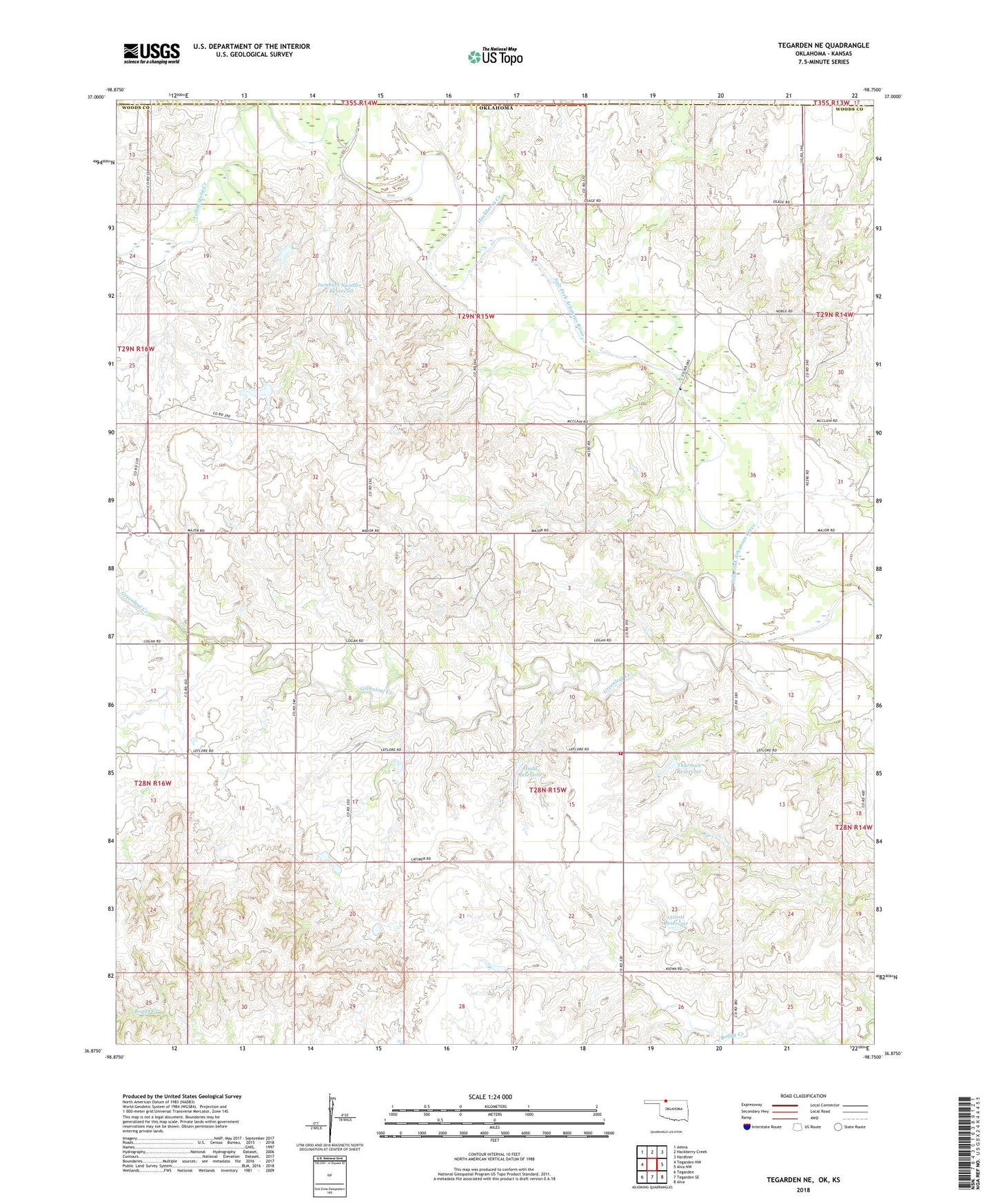
2022 topographic map quadrangle Tegarden NE in the state of Oklahoma. Scale: 1:24000. Based on the newly updated USGS 7.5' US Topo map series, this map is in the following counties: Woods, Barber. The map contains contour data, water features, and other items you are used to seeing on USGS maps, but also has updated roads and other features. This is the next generation of topographic maps. Printed on high-quality waterproof paper with UV fade-resistant inks.
Quads adjacent to this one:
West: Tegarden NW
Northwest: Aetna
North: Hackberry Creek
Northeast: Hardtner
East: Alva NW
Southeast: Alva
South: Tegarden SE
Southwest: Tegarden
This map covers the same area as the classic USGS quad with code o36098h7.
Contains the following named places: Cedar Grove Church, Cravens Dam, Cravens Reservoir, Greenleaf Creek, Greenleaf Rural Fire Department, Greenleaf School, Hackberry Creek, Hada Dam, Hada Reservoir, Isenbart Number 1 Dam, Isenbart Number 1 Reservoir, Oakes Number 1 Dam, Oakes Number 1 Reservoir, Oknoname 151001 Dam, Oknoname 151001 Reservoir, Thurman Dam, Thurman Reservoir, Township of Jefferson, Winchester, Yellowstone Creek