MyTopo
Harper Kansas US Topo Map
Couldn't load pickup availability
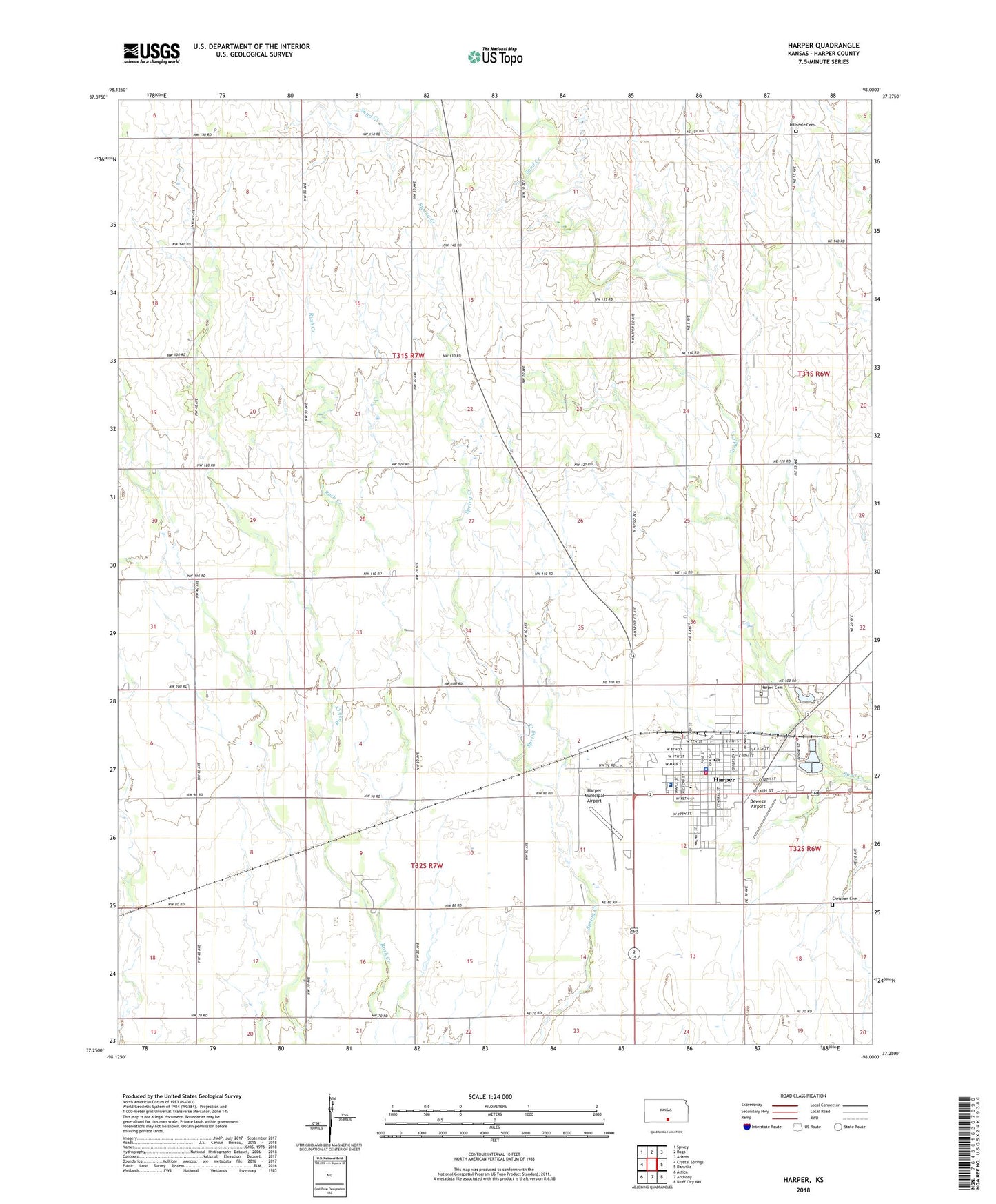
2022 topographic map quadrangle Harper in the state of Kansas. Scale: 1:24000. Based on the newly updated USGS 7.5' US Topo map series, this map is in the following counties: Harper. The map contains contour data, water features, and other items you are used to seeing on USGS maps, but also has updated roads and other features. This is the next generation of topographic maps. Printed on high-quality waterproof paper with UV fade-resistant inks.
Quads adjacent to this one:
West: Crystal Springs
Northwest: Spivey
North: Rago
Northeast: Adams
East: Danville
Southeast: Bluff City NW
South: Anthony
Southwest: Attica
This map covers the same area as the classic USGS quad with code o37098c1.
Contains the following named places: Calvary Bible Baptist Church, Christian Apostolic Cemetery, City of Harper, Community Bible Church, Deweze Airport, Eastside Church of Christ, First Presbyterian Church, Grandview School, Harper, Harper Cemetery, Harper Christian Church, Harper County Fairgrounds, Harper Elementary School, Harper Fire Department, Harper Hospital District Five, Harper Municipal Airport, Harper Police Department, Harper Post Office, Harper Public Library, Harper United Methodist Church, Harper Wastewater Treatment Facility, Hillsdale Cemetery, Pleasant Valley Mennonite Church, Saint Joan of Arc Catholic Church, ZIP Code: 67058