MyTopo
Rago Kansas US Topo Map
Couldn't load pickup availability
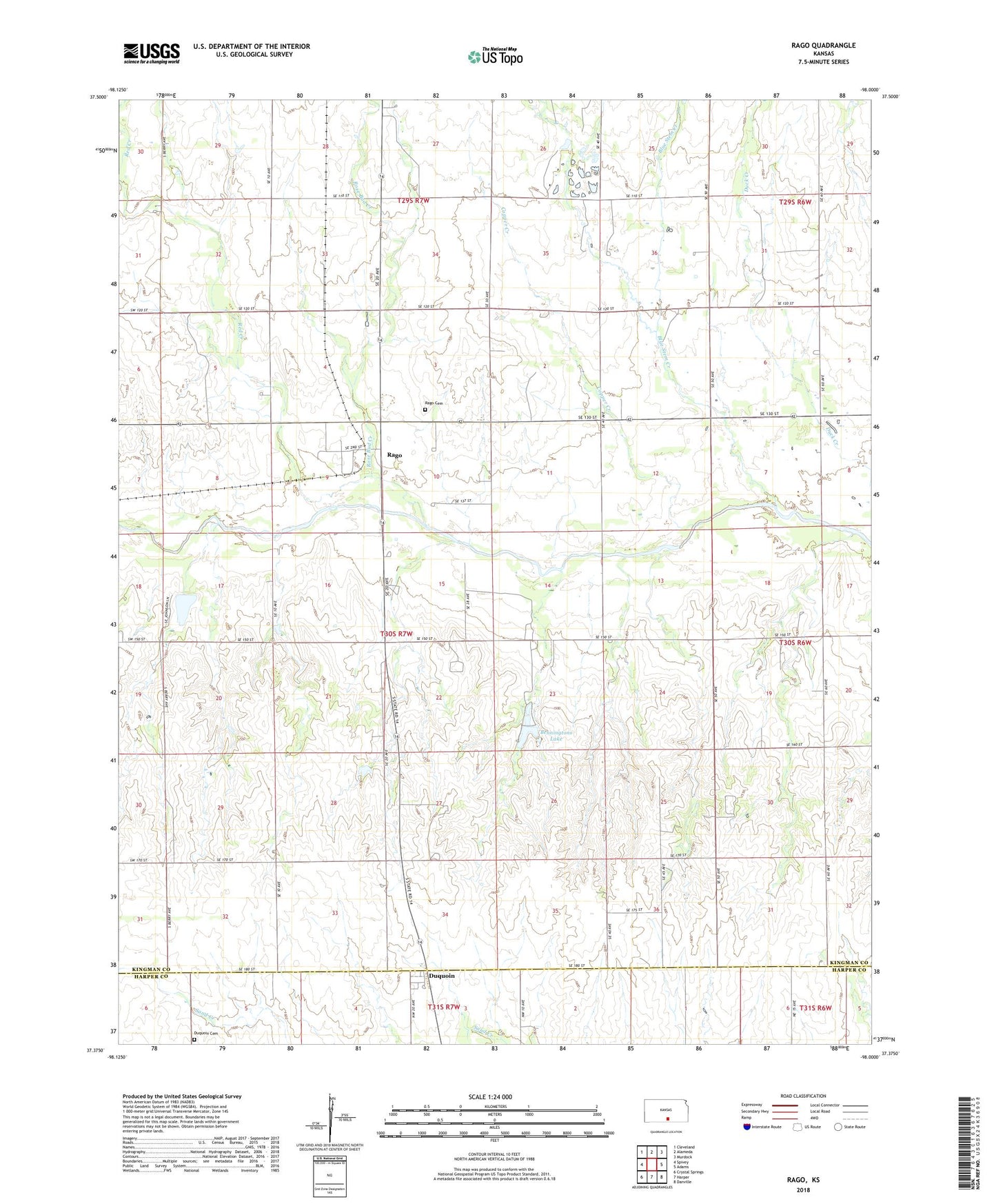
2022 topographic map quadrangle Rago in the state of Kansas. Scale: 1:24000. Based on the newly updated USGS 7.5' US Topo map series, this map is in the following counties: Kingman, Harper. The map contains contour data, water features, and other items you are used to seeing on USGS maps, but also has updated roads and other features. This is the next generation of topographic maps. Printed on high-quality waterproof paper with UV fade-resistant inks.
Quads adjacent to this one:
West: Spivey
Northwest: Cleveland
North: Alameda
Northeast: Murdock
East: Adams
Southeast: Danville
South: Harper
Southwest: Crystal Springs
This map covers the same area as the classic USGS quad with code o37098d1.
Contains the following named places: Benningtons Lake, Blue Stem Creek, Copper Creek, Duquoin, Duquoin Cemetery, Handkins Landing Strip, Little Gem School, Maple Grove School, Pitt, Rago, Rago Cemetery, Raymond School, Red Creek, Rose Bud Creek, Township of Valley, Trenton, Valley School, Yeager Lakes Dam, ZIP Code: 67142