MyTopo
Harris Draw West Kansas US Topo Map
Couldn't load pickup availability
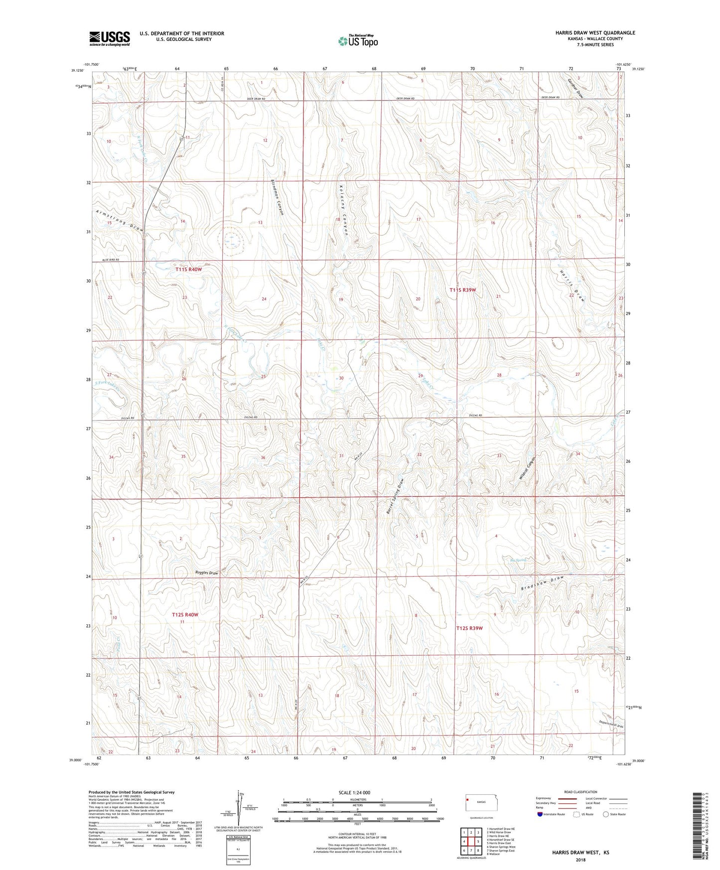
2022 topographic map quadrangle Harris Draw West in the state of Kansas. Scale: 1:24000. Based on the newly updated USGS 7.5' US Topo map series, this map is in the following counties: Wallace. The map contains contour data, water features, and other items you are used to seeing on USGS maps, but also has updated roads and other features. This is the next generation of topographic maps. Printed on high-quality waterproof paper with UV fade-resistant inks.
Quads adjacent to this one:
West: Horsethief Draw SE
Northwest: Horsethief Draw NE
North: Wild Horse Draw
Northeast: Harris Draw NE
East: Harris Draw East
Southeast: Wallace
South: Sharon Springs East
Southwest: Sharon Springs West
This map covers the same area as the classic USGS quad with code o39101a6.
Contains the following named places: Armstrong Draw, Barrel Spring Draw, Big Spring, Blindman Canyon, Grinnell High School, Kolacny Canyon, North Fork Lake Creek, Ruggles Draw, South Fork Lake Creek, Township of North, Wildcat Canyon