MyTopo
Sharon Springs West Kansas US Topo Map
Couldn't load pickup availability
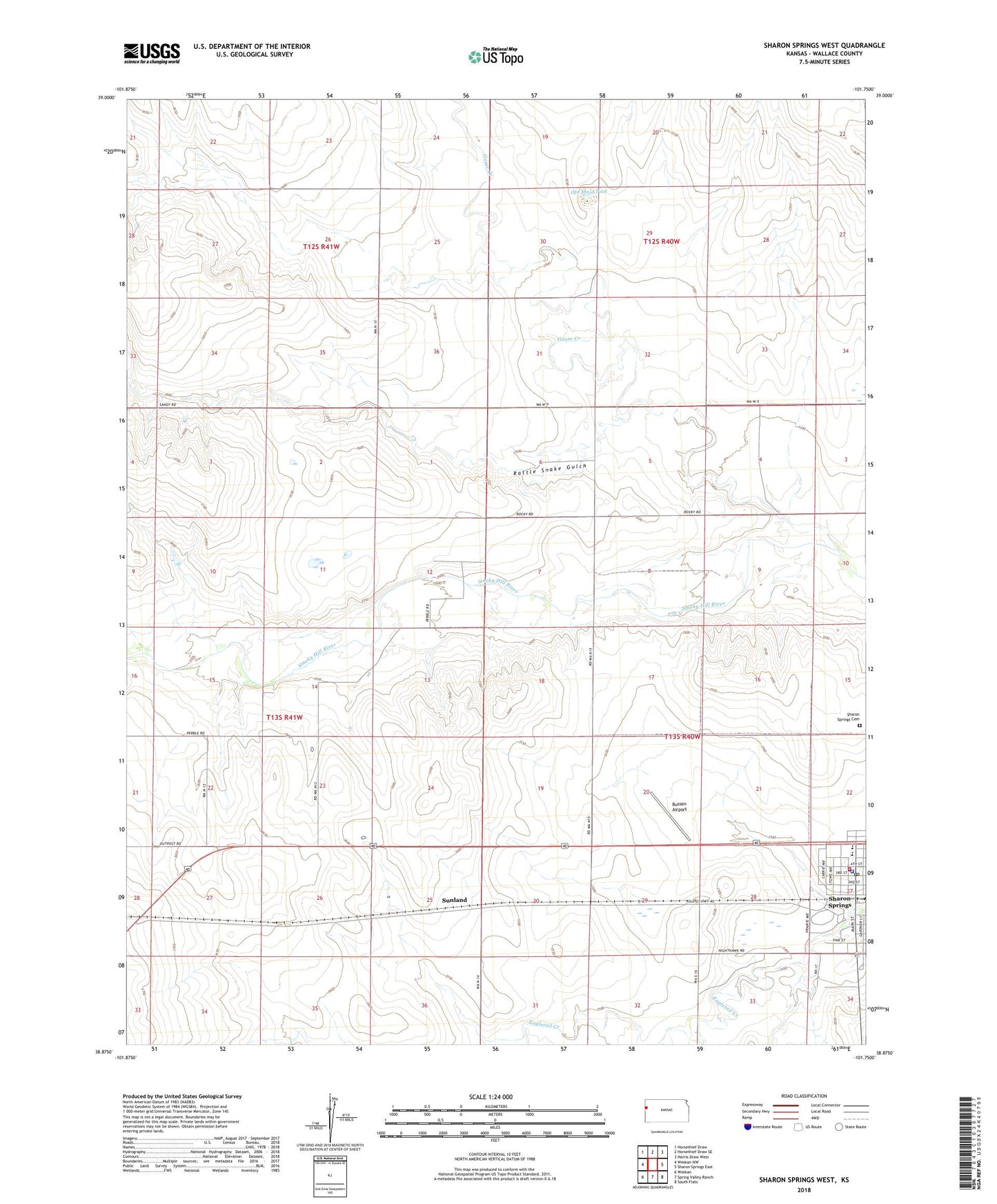
2022 topographic map quadrangle Sharon Springs West in the state of Kansas. Scale: 1:24000. Based on the newly updated USGS 7.5' US Topo map series, this map is in the following counties: Wallace. The map contains contour data, water features, and other items you are used to seeing on USGS maps, but also has updated roads and other features. This is the next generation of topographic maps. Printed on high-quality waterproof paper with UV fade-resistant inks.
Quads adjacent to this one:
West: Weskan NW
Northwest: Horsethief Draw
North: Horsethief Draw SE
Northeast: Harris Draw West
East: Sharon Springs East
Southeast: South Flats
South: Spring Valley Ranch
Southwest: Weskan
This map covers the same area as the classic USGS quad with code o38101h7.
Contains the following named places: Bussen Airport, City of Sharon Springs, Goose Creek, Hi - Plains Baptist Church, Holy Ghost Catholic Church, Lakeview Park, Old Maid Pool, Rattle Snake Gulch, Sharon Lutheran Church, Sharon Springs, Sharon Springs Cemetery, Sharon Springs Elementary / Middle School, Sharon Springs Fire Department, Sharon Springs Golf Course, Sharon Springs Municipal Power Plant, Sharon Springs Post Office, Sharon Springs Public Library, Sharon Springs United Methodist Church, Sunland, Township of Sharon Springs, Wallace County, Wallace County Courthouse, Wallace County Fairgrounds, Wallace County Health Department, Wallace County High School, Wallace County Jail, Wallace County Rural Fire Department 2, Wallace County Sheriff's Office, Wesleyan Church