MyTopo
Hays North Kansas US Topo Map
Couldn't load pickup availability
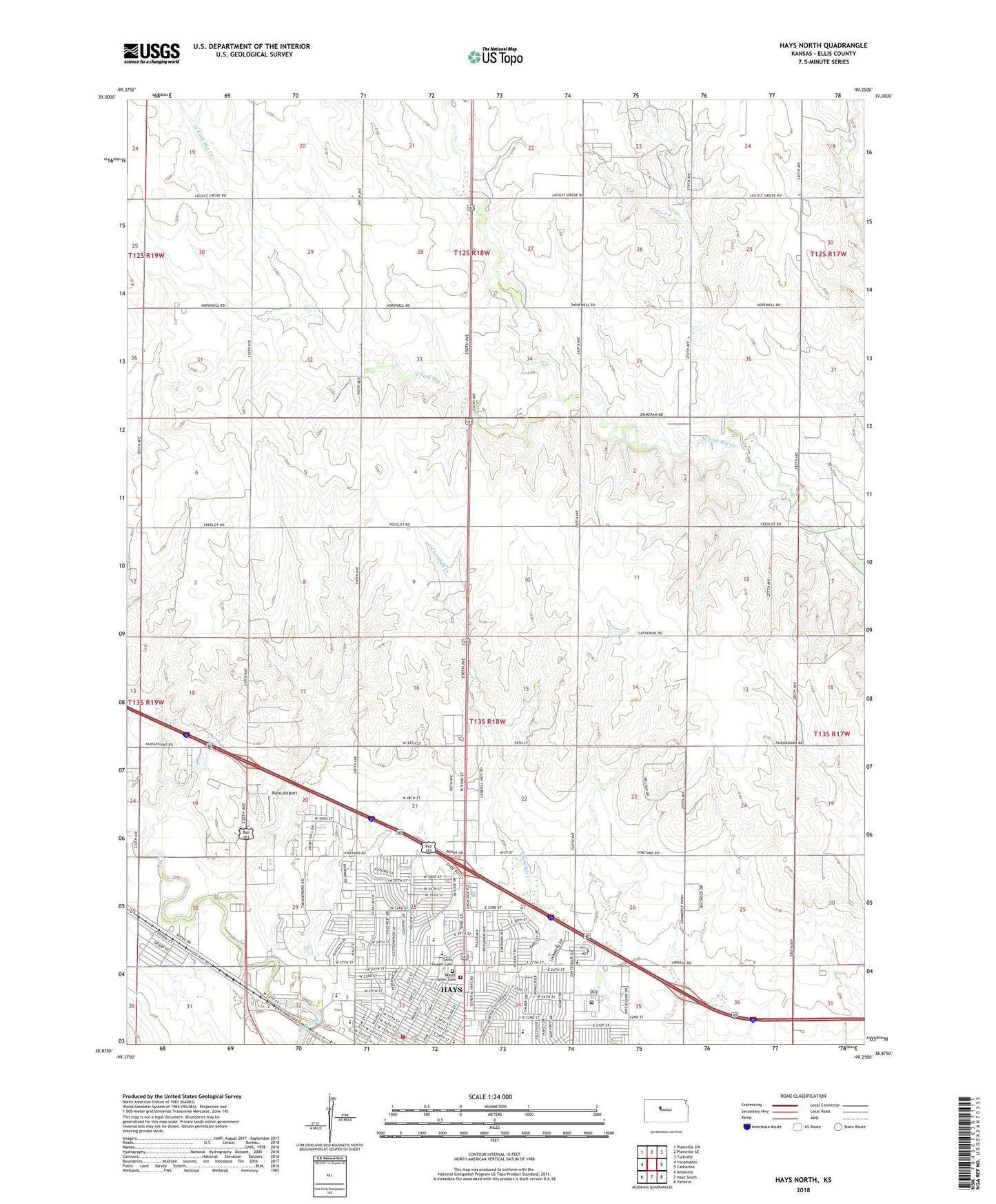
2022 topographic map quadrangle Hays North in the state of Kansas. Scale: 1:24000. Based on the newly updated USGS 7.5' US Topo map series, this map is in the following counties: Ellis. The map contains contour data, water features, and other items you are used to seeing on USGS maps, but also has updated roads and other features. This is the next generation of topographic maps. Printed on high-quality waterproof paper with UV fade-resistant inks.
Quads adjacent to this one:
West: Yocemento
Northwest: Plainville SW
North: Plainville SE
Northeast: Turkville
East: Catharine
Southeast: Victoria
South: Hays South
Southwest: Antonino
This map covers the same area as the classic USGS quad with code o38099h3.
Contains the following named places: Aubel Bickle Park, Celebration Community Church, Centennial Mall, Church of Christ, City of Hays, Cornerstone Southern Baptist Church, Daniel G Rupp Memorial Park, Elizabeth Polly Park, Ellis County, Ellis County American Red Cross, Ellis County Emergency Medical Services, Ellis County Fairgrounds, First Presbyterian Church, Fort Hays State University Brooks Building, Fort Hays State University C A Witt Building, Hays, Hays Christian Church, Hays City Hall, Hays Fire Department Station 1, Hays Medical Center, Hays Medical Center Heliport, Hays Middle School, Hays Welcome Center, Hickock Park, High Plains Baptist Church, High Plains Christian School, High Plains Church of God, Holy Family Elementary School, Immaculate Heart of Mary Catholic Church, Kansas Highway Patrol Troop D Headquarters, KAYS-AM (Hays), KAYS-TV (Hays), KBSH - TV (Hays), Kennedy Middle School, KHAZ - FM (Hays), KJLS-FM (Hays), KZAN - FM (Hays), Lincoln Elementary School, Messiah Lutheran Church, Mount Allen Cemetery, New Life Center Assembly of God Church, North Oak Community Church, North Ridge Shopping Center, Oak Plaza Shopping Center, O'Loughlin Elementary School, Rans Airport, Rolling Hills Disc Golf Course, Rolling Plains Motor Speedway, Roosevelt Elementary School, Saint Anthony Hospital Airport, Saint Joseph Cemetery, Saint Joseph Grade School, Saint Joseph's Catholic Church, Saint Michael's Episcopal Church, Seven Hills Park, Smoky Hill Country Club, Sternberg Museum of Natural History, Sunrise Park, The Church of Jesus Christ of Latter Day Saints, The Mall, Thomas More Prep - Marian Junior / Senior High School, Thomas More Preparatory Marian High School, Trinity Lutheran Church, Westview Church, Whisnant Park, Wilson Elementary School, ZIP Code: 67601