MyTopo
Herndon Kansas US Topo Map
Couldn't load pickup availability
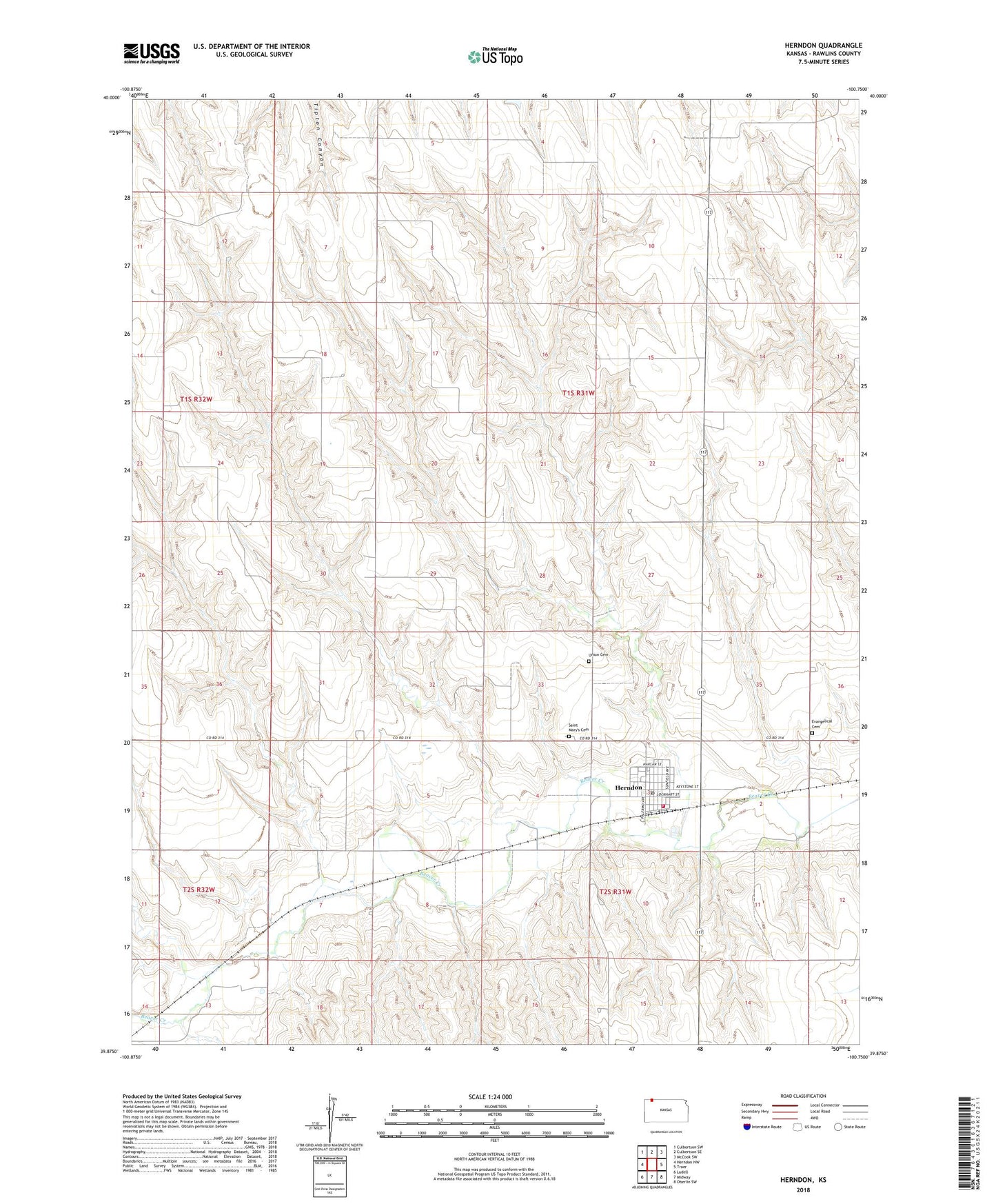
2022 topographic map quadrangle Herndon in the state of Kansas. Scale: 1:24000. Based on the newly updated USGS 7.5' US Topo map series, this map is in the following counties: Rawlins. The map contains contour data, water features, and other items you are used to seeing on USGS maps, but also has updated roads and other features. This is the next generation of topographic maps. Printed on high-quality waterproof paper with UV fade-resistant inks.
Quads adjacent to this one:
West: Herndon NW
Northwest: Culbertson SW
North: Culbertson SE
Northeast: McCook SW
East: Traer
Southeast: Oberlin SW
South: Midway
Southwest: Ludell
This map covers the same area as the classic USGS quad with code o39100h7.
Contains the following named places: City of Herndon, Evangelical Cemetery, Herndon, Herndon City Library, Herndon Elemmentary School, Herndon Fire Department, Herndon High School, Herndon Municipal Power Plant, Herndon Post Office, Herndon Wastewater Plant, Immanuel United Church of Christ, Rawlins County Fire District 1 Herndon, Saint Marys Cemetery, Saint Mary's Church, School Number 208, Union Cemetery, ZIP Code: 67739