MyTopo
Laird Kansas US Topo Map
Couldn't load pickup availability
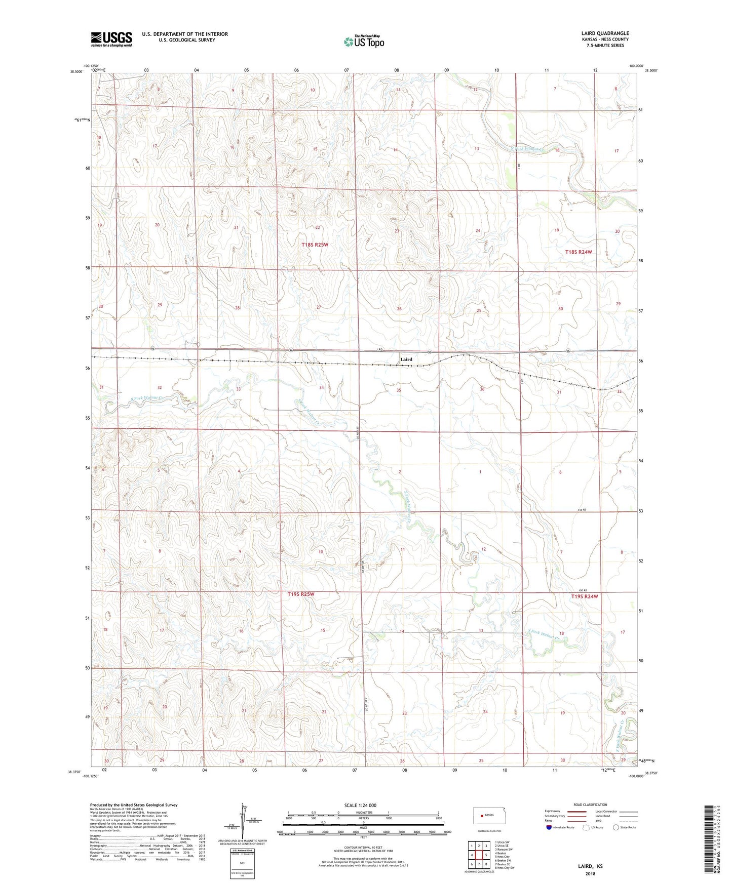
2022 topographic map quadrangle Laird in the state of Kansas. Scale: 1:24000. Based on the newly updated USGS 7.5' US Topo map series, this map is in the following counties: Ness. The map contains contour data, water features, and other items you are used to seeing on USGS maps, but also has updated roads and other features. This is the next generation of topographic maps. Printed on high-quality waterproof paper with UV fade-resistant inks.
Quads adjacent to this one:
West: Beeler
Northwest: Utica SW
North: Utica SE
Northeast: Ransom SW
East: Ness City
Southeast: Ness City SW
South: Beeler SE
Southwest: Beeler SW
This map covers the same area as the classic USGS quad with code o38100d1.
Contains the following named places: Challacombe, D E Bondurant Grain Company Grain Elevator Number 2, Laird, Sunshine Oil Field