MyTopo
Ransom SW Kansas US Topo Map
Couldn't load pickup availability
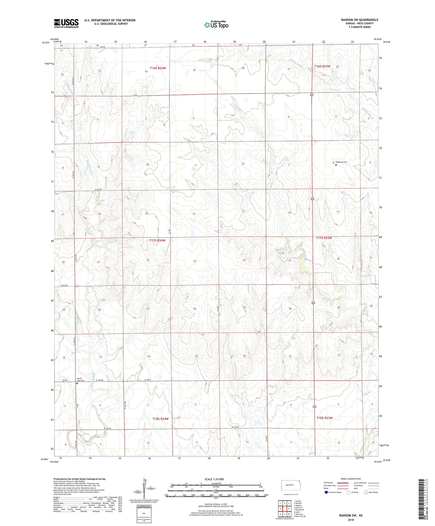
2022 topographic map quadrangle Ransom SW in the state of Kansas. Scale: 1:24000. Based on the newly updated USGS 7.5' US Topo map series, this map is in the following counties: Ness. The map contains contour data, water features, and other items you are used to seeing on USGS maps, but also has updated roads and other features. This is the next generation of topographic maps. Printed on high-quality waterproof paper with UV fade-resistant inks.
Quads adjacent to this one:
West: Utica SE
Northwest: Arnold
North: Ransom
Northeast: Osgood
East: Ransom SE
Southeast: Ness City NE
South: Ness City
Southwest: Laird
This map covers the same area as the classic USGS quad with code o38099e8.
Contains the following named places: Dagenett Cemetery, Forrester Creek, Ness County Country Club, Nevada, North Star Cemetery, Township of Forrester