MyTopo
Lake City Kansas US Topo Map
Couldn't load pickup availability
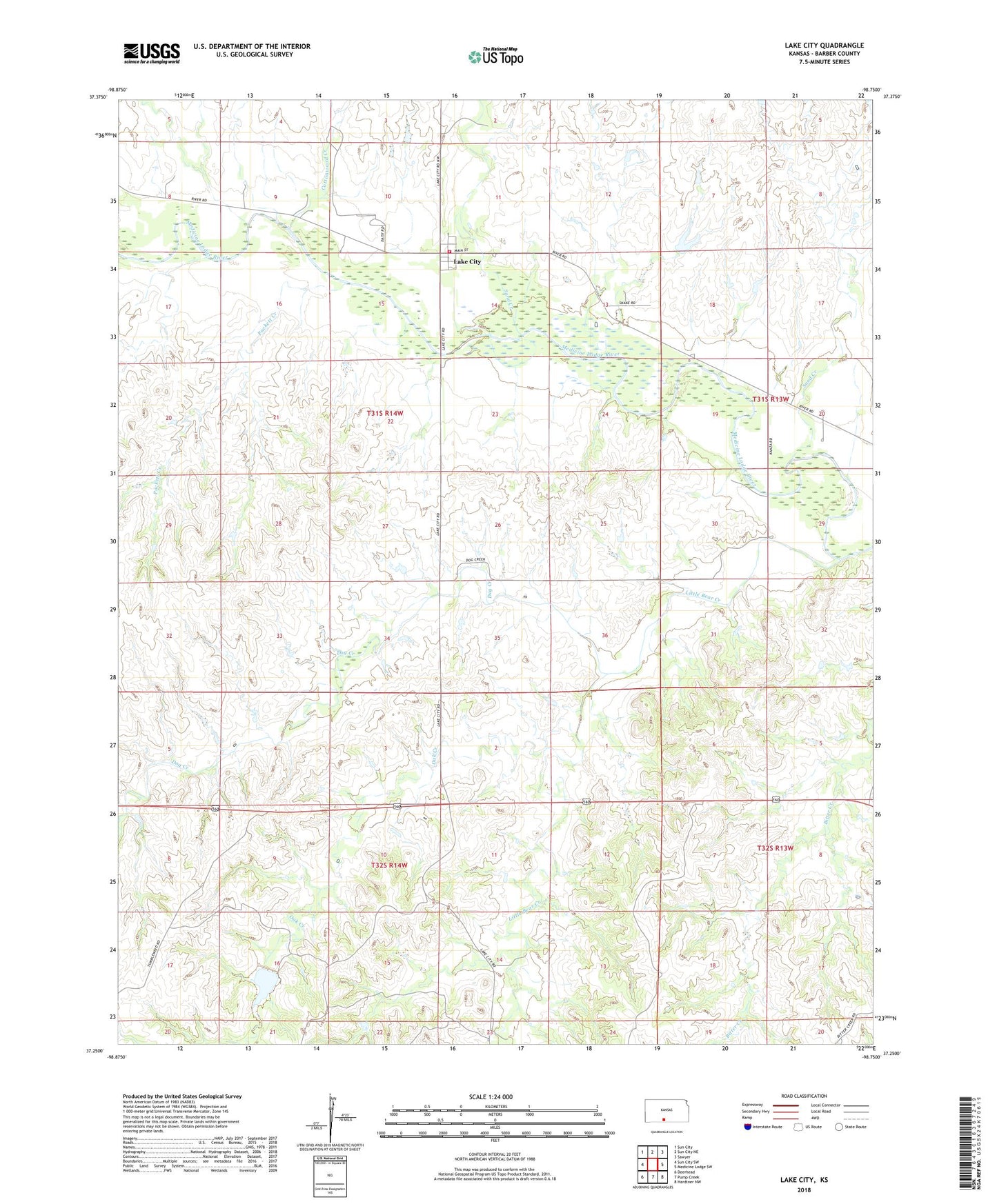
2022 topographic map quadrangle Lake City in the state of Kansas. Scale: 1:24000. Based on the newly updated USGS 7.5' US Topo map series, this map is in the following counties: Barber. The map contains contour data, water features, and other items you are used to seeing on USGS maps, but also has updated roads and other features. This is the next generation of topographic maps. Printed on high-quality waterproof paper with UV fade-resistant inks.
Quads adjacent to this one:
West: Sun City SW
Northwest: Sun City
North: Sun City NE
Northeast: Sawyer
East: Medicine Lodge SW
Southeast: Hardtner NW
South: Pump Creek
Southwest: Deerhead
This map covers the same area as the classic USGS quad with code o37098c7.
Contains the following named places: Cottonwood Creek, Dog Creek, Lake City, Lake City Census Designated Place, Lake City Volunteer Fire Department, Little Bear Creek, Mills Landing Strip, Oak Creek, Puckett Creek, Sand Creek, Township of Lake City