MyTopo
Little River Kansas US Topo Map
Couldn't load pickup availability
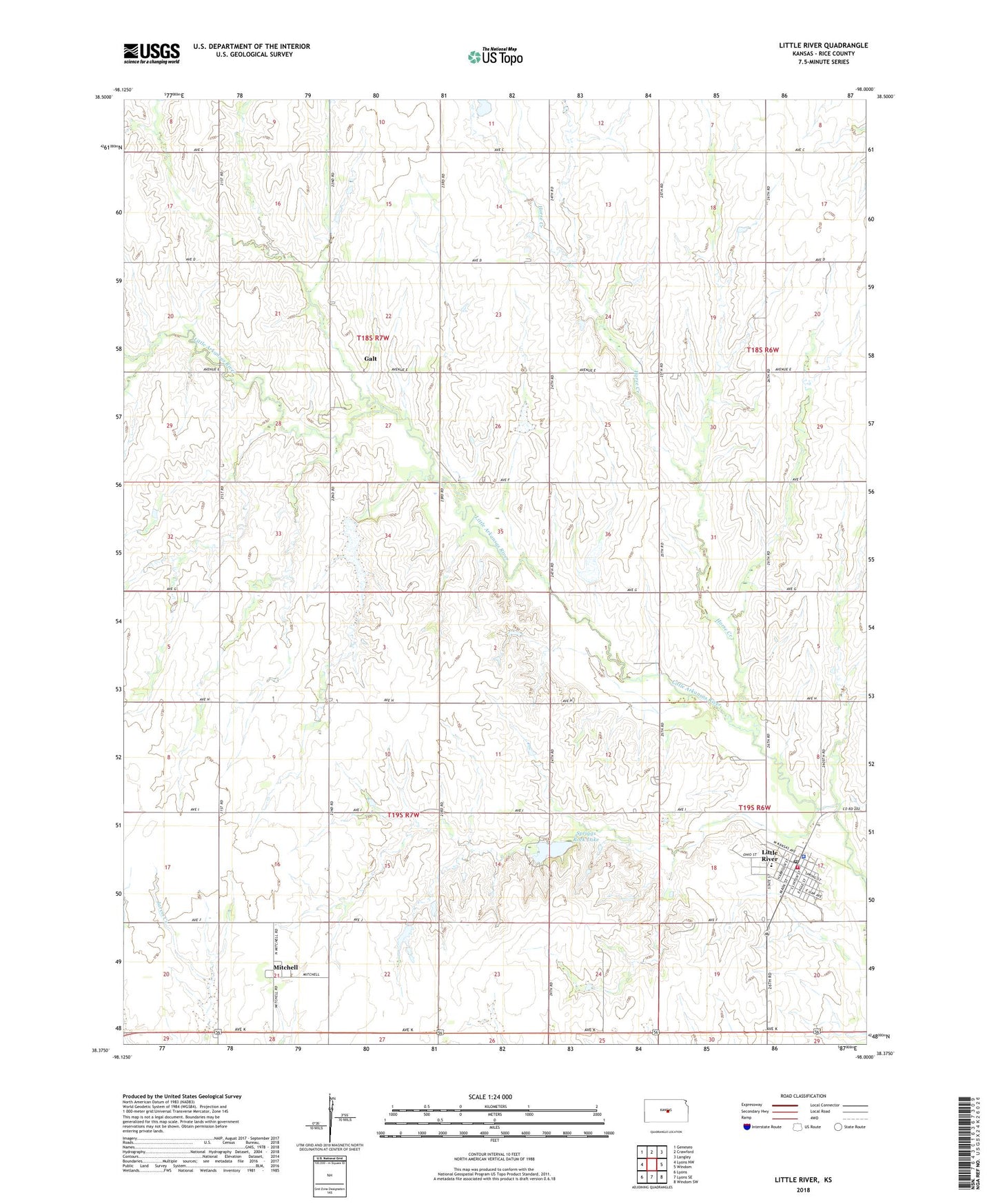
2022 topographic map quadrangle Little River in the state of Kansas. Scale: 1:24000. Based on the newly updated USGS 7.5' US Topo map series, this map is in the following counties: Rice. The map contains contour data, water features, and other items you are used to seeing on USGS maps, but also has updated roads and other features. This is the next generation of topographic maps. Printed on high-quality waterproof paper with UV fade-resistant inks.
Quads adjacent to this one:
West: Lyons NW
Northwest: Geneseo
North: Crawford
Northeast: Langley
East: Windom
Southeast: Windom SW
South: Lyons SE
Southwest: Lyons
This map covers the same area as the classic USGS quad with code o38098d1.
Contains the following named places: City of Little River, Crawford Oil Field, Galt, Holy Trinity Catholic Church, Horse Creek, Little River, Little River City Hall, Little River Community Library, Little River Congregational Church, Little River Dam, Little River Elementary School, Little River Fire Department, Little River Junior / Senior High School, Little River Middle School, Little River Police Department, Little River Post Office, Little River United Methodist Church, Mitchell, Odessa Oil Field, Spriggs Rock Lake, Township of Galt, Township of Mitchell