MyTopo
Geneseo Kansas US Topo Map
Couldn't load pickup availability
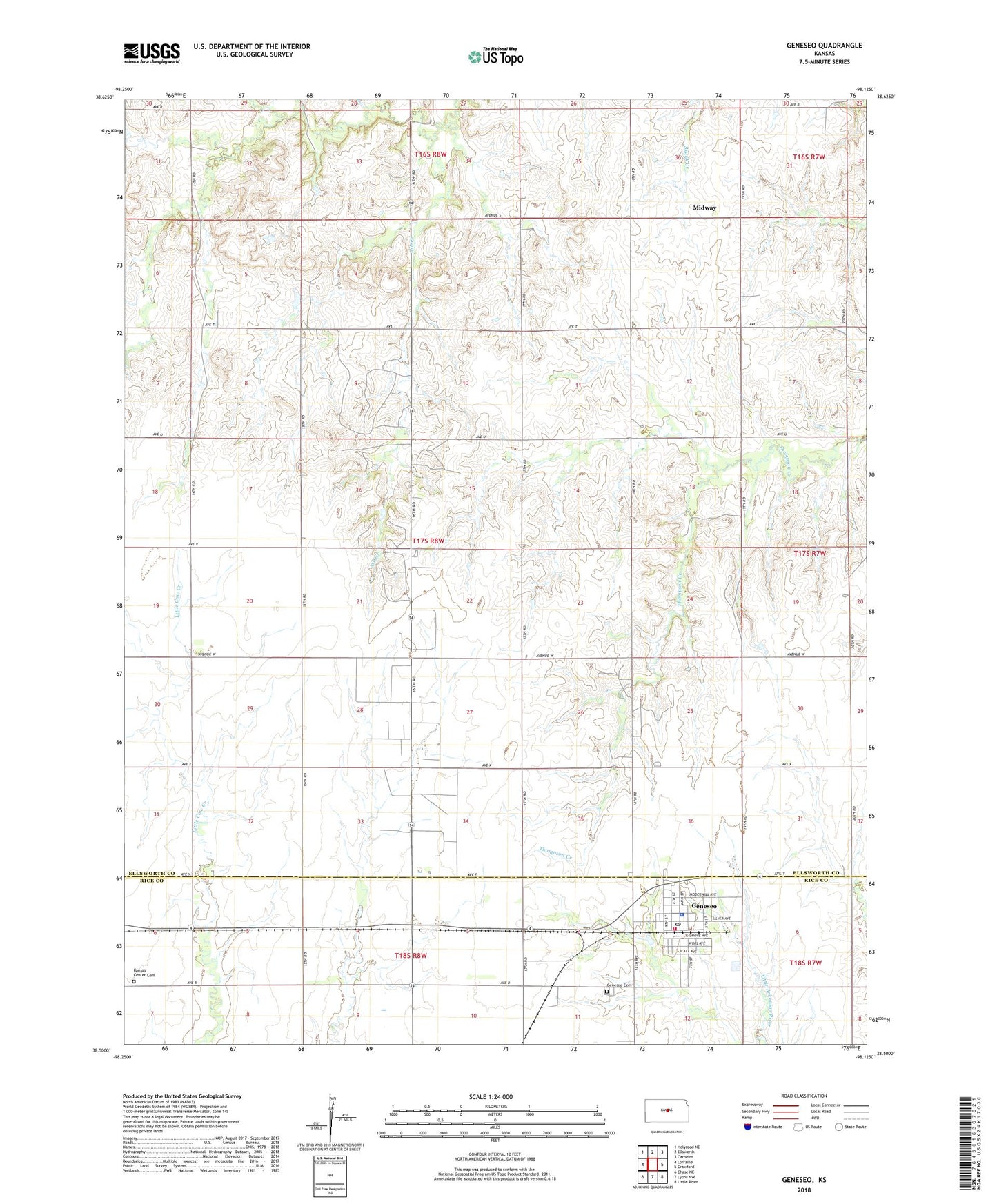
2022 topographic map quadrangle Geneseo in the state of Kansas. Scale: 1:24000. Based on the newly updated USGS 7.5' US Topo map series, this map is in the following counties: Ellsworth, Rice. The map contains contour data, water features, and other items you are used to seeing on USGS maps, but also has updated roads and other features. This is the next generation of topographic maps. Printed on high-quality waterproof paper with UV fade-resistant inks.
Quads adjacent to this one:
West: Lorraine
Northwest: Holyrood NE
North: Ellsworth
Northeast: Carneiro
East: Crawford
Southeast: Little River
South: Lyons NW
Southwest: Chase NE
This map covers the same area as the classic USGS quad with code o38098e2.
Contains the following named places: Andrews Oil Field, City of Geneseo, Frantz, Geneseo, Geneseo Cemetery, Geneseo City Hall, Geneseo Elementary School, Geneseo Fire Department, Geneseo Golf Club, Geneseo Police Department, Geneseo Post Office, Geneseo Public Library, Geneseo Senior Center, Geneseo United Methodist Church, Geneseo Wastewater Treatment Facility, Geneseo-Edwards Oil Field, Kansas Center Cemetery, Maes Oil Field, Midway, Thomas, Thomas School, Township of Thomas, ZIP Code: 67444