MyTopo
Maple Hill Kansas US Topo Map
Couldn't load pickup availability
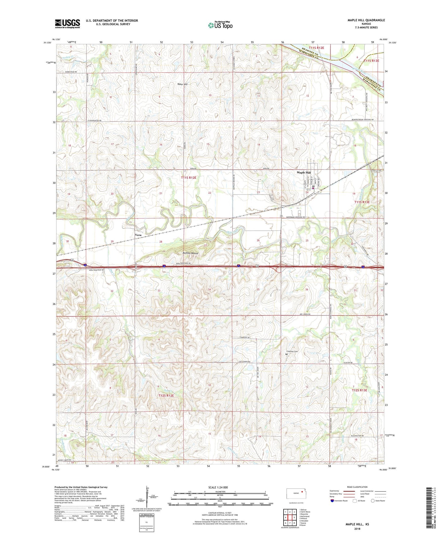
2022 topographic map quadrangle Maple Hill in the state of Kansas. Scale: 1:24000. Based on the newly updated USGS 7.5' US Topo map series, this map is in the following counties: Wabaunsee, Shawnee. The map contains contour data, water features, and other items you are used to seeing on USGS maps, but also has updated roads and other features. This is the next generation of topographic maps. Printed on high-quality waterproof paper with UV fade-resistant inks.
Quads adjacent to this one:
West: McFarland
Northwest: Belvue
North: Saint Marys
Northeast: Rossville
East: Willard
Southeast: Dover
South: Keene
Southwest: Hessdale
This map covers the same area as the classic USGS quad with code o39096a1.
Contains the following named places: Bourbonnais Creek, Buffalo Mound, City of Maple Hill, Dog Creek, Dry Creek, Freeman Cemetery, Fuller Airfield, Kansas Department of Transportation Wabaunsee County Rest Area, Maple Hill, Maple Hill Church, Maple Hill Community Congregational Church, Maple Hill Grade School, Maple Hill Police Department, Maple Hill Post Office, Maple Hill Wastewater Treatment Plant, Morelock Airport, Springside, Sunny Side School, Tabor Hill, Township of Maple Hill, Vera, Wabaunsee County Fire District 4, WIBW-FM (Topeka), WIBW-TV (Topeka), ZIP Code: 66507