MyTopo
McFarland Kansas US Topo Map
Couldn't load pickup availability
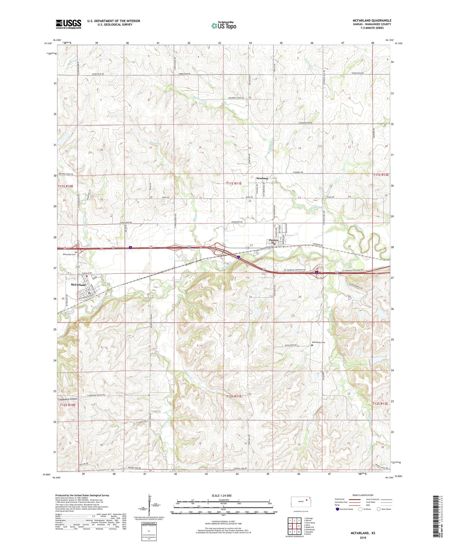
2022 topographic map quadrangle McFarland in the state of Kansas. Scale: 1:24000. Based on the newly updated USGS 7.5' US Topo map series, this map is in the following counties: Wabaunsee. The map contains contour data, water features, and other items you are used to seeing on USGS maps, but also has updated roads and other features. This is the next generation of topographic maps. Printed on high-quality waterproof paper with UV fade-resistant inks.
Quads adjacent to this one:
West: Alma
Northwest: Wamego
North: Belvue
Northeast: Saint Marys
East: Maple Hill
Southeast: Keene
South: Hessdale
Southwest: Allendorph
This map covers the same area as the classic USGS quad with code o39096a2.
Contains the following named places: Bethlehem Cemetery, City of McFarland, City of Paxico, Joe Woody Branch, Kuenzli Creek, McFarland, McFarland Cemetery, McFarland City Hall, McFarland Detention Dam, McFarland Post Office, McFarland Sewer Treatment Plant, Mill Creek Baptist Church, Mill Creek Campground and Recreational Vehicle Park, Mill Creek Valley Junior High School, Mill Creek Valley Middle School, Mulberry Creek, Newbury, Newbury Census Designated Place, Paw Paw Creek, Paxico, Paxico Post Office, Paxico Sewer Treatment Plant, Paxico United Methodist Church, Pierce Creek, Pretty Creek, Sacred Heart Catholic Church, Snokomo Creek, Spring Creek, Township of Newbury, Trinity Lutheran Church, Wabaunsee County Fire District 7, Wabaunsee County Sewer District Number 1 Wastewater Treatment Plant, ZIP Codes: 66501, 66526