MyTopo
Melrose Kansas US Topo Map
Couldn't load pickup availability
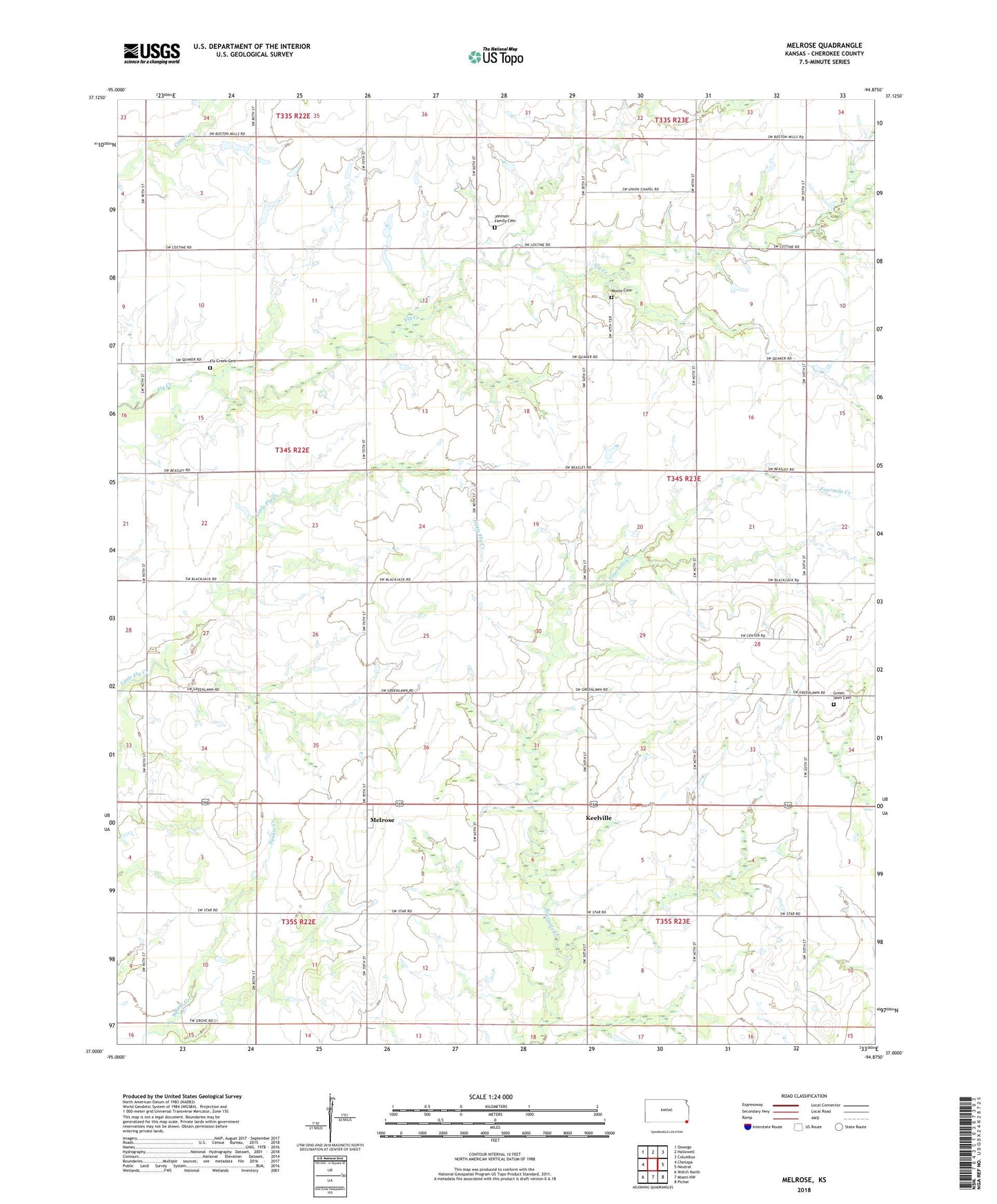
2023 topographic map quadrangle Melrose in the state of Kansas. Scale: 1:24000. Based on the newly updated USGS 7.5' US Topo map series, this map is in the following counties: Cherokee. The map contains contour data, water features, and other items you are used to seeing on USGS maps, but also has updated roads and other features. This is the next generation of topographic maps. Printed on high-quality waterproof paper with UV fade-resistant inks.
Quads adjacent to this one:
West: Chetopa
Northwest: Oswego
North: Hallowell
Northeast: Columbus
East: Neutral
Southeast: Picher
South: Miami NW
Southwest: Welch North
This map covers the same area as the classic USGS quad with code o37094a8.
Contains the following named places: Center Christian Church, Center School, Fairview School, Fly Creek Cemetery, Fourmile School, Frontier School, Green lawn Cemetery, Greenlawn Elementary School, Hopewell School, Ingram School, Johnson Family Cemetery, Keelville, Keelville Church, Melrose, Melrose United Methodist Church, Mount Pisgah School, Mount Pleasant School, Newton Moore Cemetery, Pleasant Hill Baptist Church, Pleasant Valley School, Township of Lyon, Whitehall