MyTopo
Chetopa Kansas US Topo Map
Couldn't load pickup availability
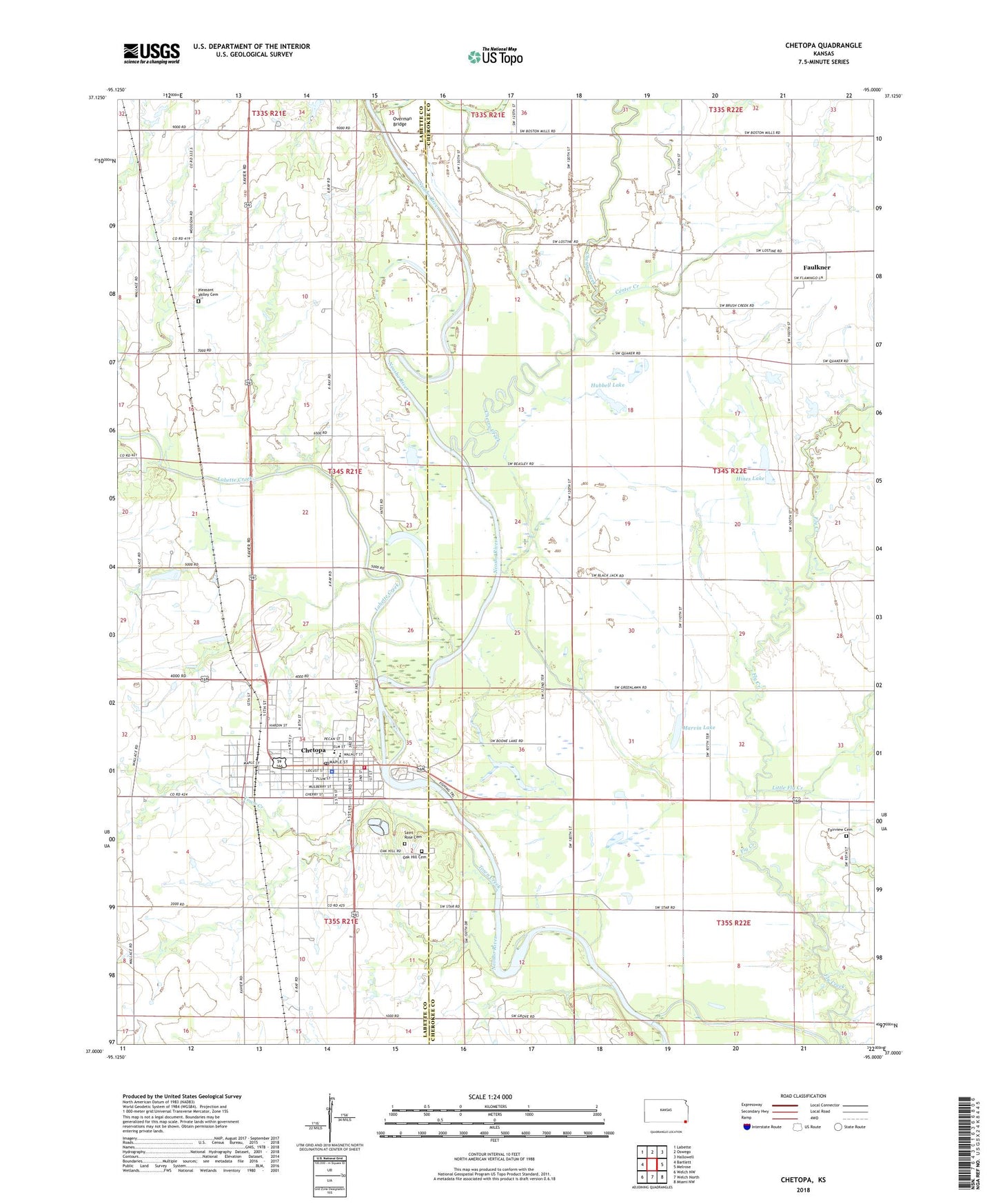
2022 topographic map quadrangle Chetopa in the state of Kansas. Scale: 1:24000. Based on the newly updated USGS 7.5' US Topo map series, this map is in the following counties: Cherokee, Labette. The map contains contour data, water features, and other items you are used to seeing on USGS maps, but also has updated roads and other features. This is the next generation of topographic maps. Printed on high-quality waterproof paper with UV fade-resistant inks.
Quads adjacent to this one:
West: Bartlett
Northwest: Labette
North: Oswego
Northeast: Hallowell
East: Melrose
Southeast: Miami NW
South: Welch North
Southwest: Welch NW
This map covers the same area as the classic USGS quad with code o37095a1.
Contains the following named places: Bartlett Co - Operative Association Grain Elevator Number 2, Big Candy Lake, Boone Lake, Breece School, Center Creek, Cherry Creek, Chetopa, Chetopa City Hall, Chetopa City Library, Chetopa Elementary School, Chetopa High School, Chetopa Historical Museum, Chetopa Police Department, Chetopa Post Office, Chetopa Saint Paul United Methodist Church, Chetopa United Methodist Church, Chetopa Volunteer Fire Department, Chetopa Wastewater Treatment Plant, Church of God, City of Chetopa, Community Bible Church, Elmore Park, Fairview Cemetery, Faith Baptist Church, Faulkner, Faulkner Grain Elevator Number 1, First Baptist Church, First Christian Church, Gore School, Harmon Wildlife Area, Hines Lake, Hubbell Lake, Jarrett School, Labette Creek, Little Candy Lake, Little Fly Creek, Marvin Lake, Mosquito Valley School, Oak Hill Cemetery, Oak Valley School, Overman Bridge, Piety School, Pleasant Valley Cemetery, Saint Rose Cemetery, Short Creek, Sunnyside School, Town Creek, Township of Neosho, Township of Richland, Union School, Watson School, ZIP Code: 67336