MyTopo
Menlo Kansas US Topo Map
Couldn't load pickup availability
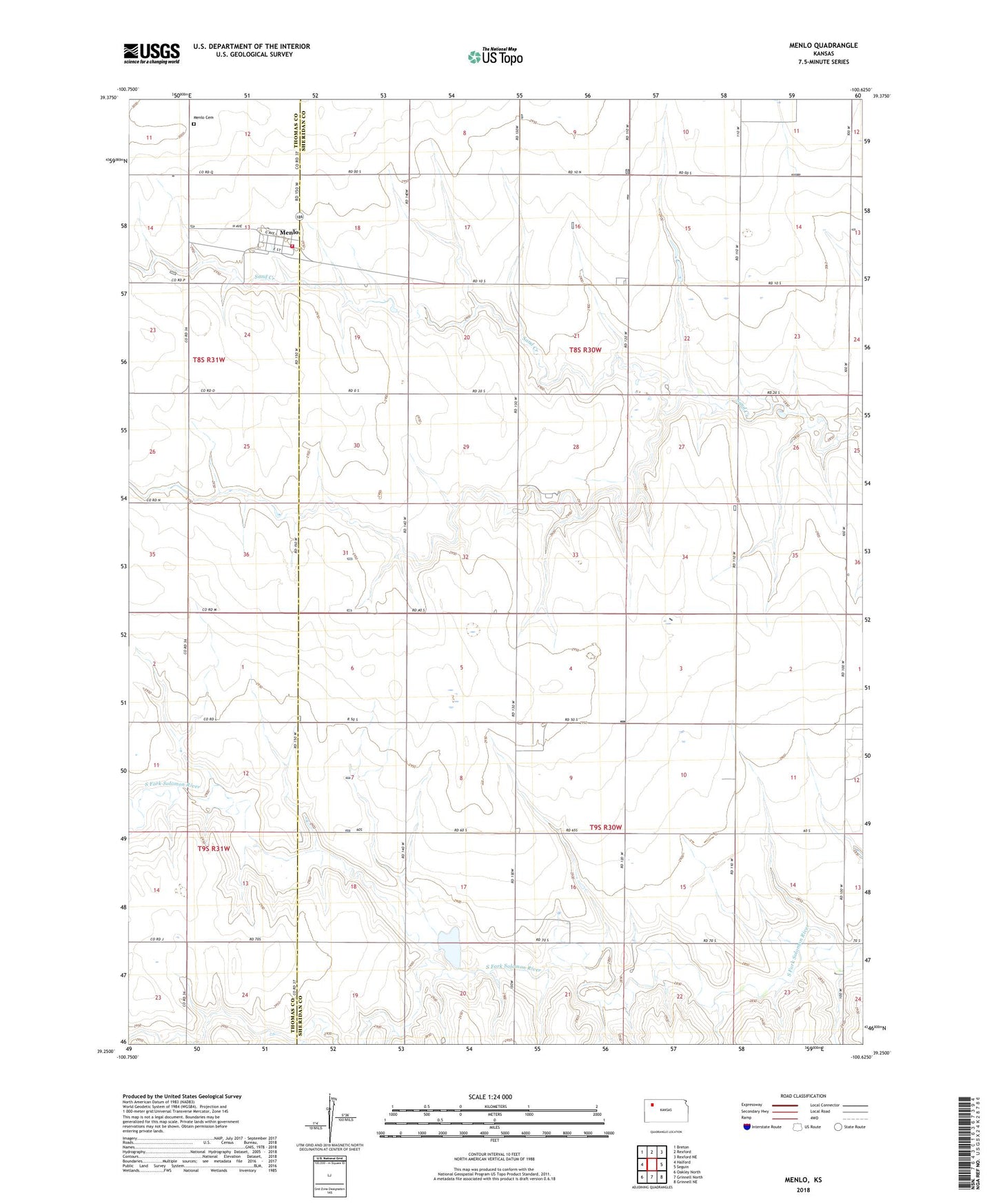
2022 topographic map quadrangle Menlo in the state of Kansas. Scale: 1:24000. Based on the newly updated USGS 7.5' US Topo map series, this map is in the following counties: Sheridan, Thomas. The map contains contour data, water features, and other items you are used to seeing on USGS maps, but also has updated roads and other features. This is the next generation of topographic maps. Printed on high-quality waterproof paper with UV fade-resistant inks.
Quads adjacent to this one:
West: Halford
Northwest: Breton
North: Rexford
Northeast: Rexford NE
East: Seguin
Southeast: Grinnell NE
South: Grinnell North
Southwest: Oakley North
This map covers the same area as the classic USGS quad with code o39100c6.
Contains the following named places: City of Menlo, Frontier Agricultural Grain Elevator Number 7, Menlo, Menlo Cemetery, Menlo Fire Department