MyTopo
Oakley North Kansas US Topo Map
Couldn't load pickup availability
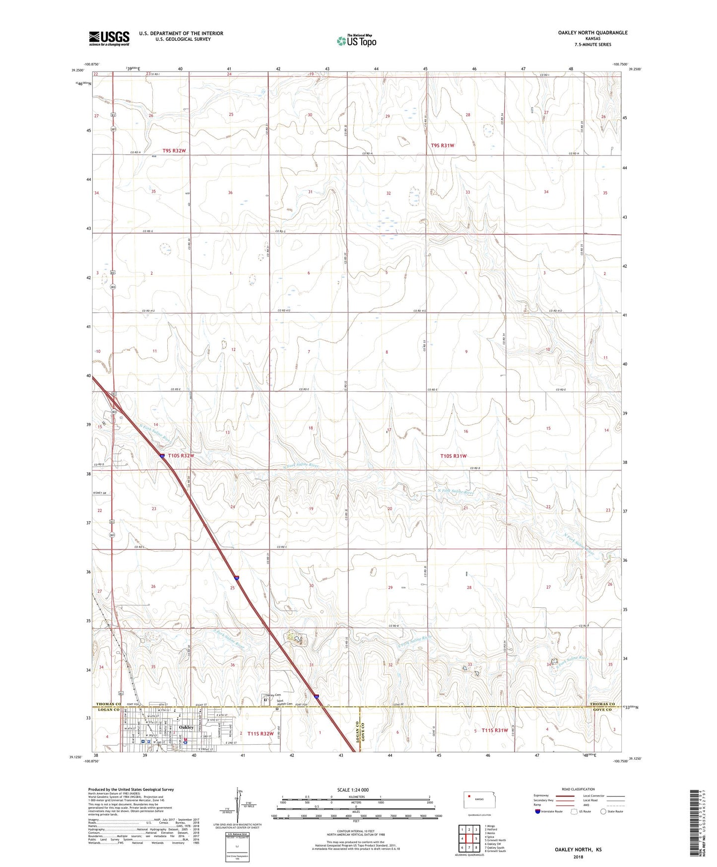
2022 topographic map quadrangle Oakley North in the state of Kansas. Scale: 1:24000. Based on the newly updated USGS 7.5' US Topo map series, this map is in the following counties: Thomas, Logan, Gove. The map contains contour data, water features, and other items you are used to seeing on USGS maps, but also has updated roads and other features. This is the next generation of topographic maps. Printed on high-quality waterproof paper with UV fade-resistant inks.
Quads adjacent to this one:
West: Spica
Northwest: Mingo
North: Halford
Northeast: Menlo
East: Grinnell North
Southeast: Grinnell South
South: Oakley South
Southwest: Oakley SW
This map covers the same area as the classic USGS quad with code o39100b7.
Contains the following named places: Annie Oakley Park, Bertrand Park, Fick Fossil and History Museum, Gateway Fellowship Church, High Plains Camping Facility, Immanuel Lutheran Church, Kansas Highway Patrol Troop D Logan, Logan County Courthouse, Logan County Emergency Medical Services, Logan County Fairgrounds, Logan County Health Department, Logan County Hospital, Logan County Sheriff's Office, Mount Olive Baptist Church, Northwest Kansas Educational Service Center, Oakley, Oakley Area Chamber of Commerce, Oakley Cemetery, Oakley Christian Church, Oakley Church of Christ, Oakley City Hall, Oakley City Jail, Oakley Community Church, Oakley Elementary School, Oakley Fire Department, Oakley Middle School, Oakley Municipal Power Plant, Oakley Police Department, Oakley Post Office, Oakley Public Library, Oakley Senior High School, Oakley United Methodist Church, Oakley Wesleyan Church, Saint Joseph Catholic School, Saint Joseph Cemetery, Saint Josephs Catholic Church, Sunrise Baptist Church, Township of South Randall